S44A Carbondale, IL, USA - Earthquake Result Viewer
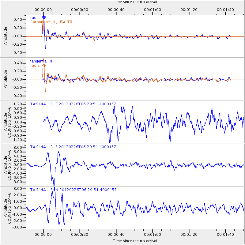
Earthquake location: Southwestern Siberia, Russia
Earthquake latitude/longitude: 51.7/96.0
Earthquake time(UTC): 2012/02/26 (057) 06:17:19 GMT
Earthquake Depth: 12 km
Earthquake Magnitude: 6.4 MB, 6.6 MS, 6.7 MW, 6.5 MW
Earthquake Catalog/Contributor: WHDF/NEIC
Network: TA USArray Transportable Network (new EarthScope stations)
Station: S44A Carbondale, IL, USA
Lat/Lon: 37.69 N/89.26 W
Elevation: 155 m
Distance: 90.9 deg
Az: 4.16 deg
Baz: 356.738 deg
Ray Param: 0.041643433
Estimated Moho Depth: 19.75 km
Estimated Crust Vp/Vs: 1.84
Assumed Crust Vp: 6.444 km/s
Estimated Crust Vs: 3.507 km/s
Estimated Crust Poisson's Ratio: 0.29
Radial Match: 87.23731 %
Radial Bump: 400
Transverse Match: 72.81085 %
Transverse Bump: 400
SOD ConfigId: 440406
Insert Time: 2012-05-15 05:21:49.581 +0000
GWidth: 2.5
Max Bumps: 400
Tol: 0.001

Signal To Noise

ChannelStoNSTALTA
TA:S44A: :BHZ:20120226T06:29:51.400015Z7.49779753.2291955E-64.3068587E-7
TA:S44A: :BHN:20120226T06:29:51.400015Z4.1294861.1357993E-62.7504615E-7
TA:S44A: :BHE:20120226T06:29:51.400015Z1.53163494.1986695E-72.7412992E-7
Arrivals
Ps2.6 SECOND
PpPs8.5 SECOND
PsPs/PpSs11 SECOND