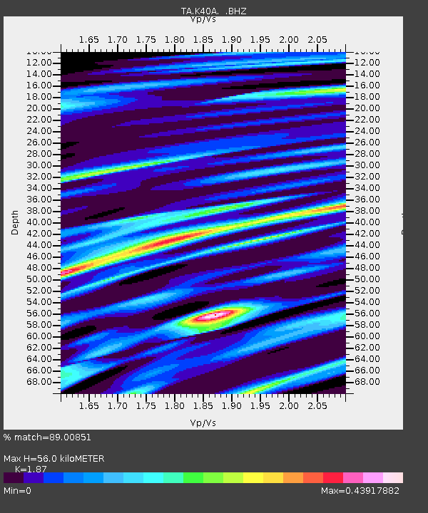
K40A Colesburg, IA, USA - Earthquake Result Viewer
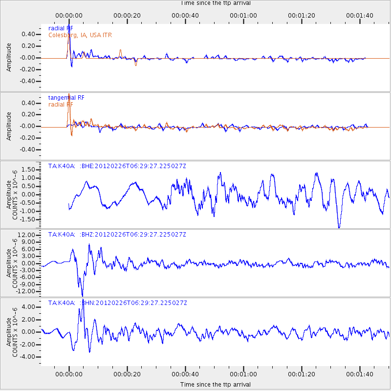
Earthquake location: Southwestern Siberia, Russia
Earthquake latitude/longitude: 51.7/96.0
Earthquake time(UTC): 2012/02/26 (057) 06:17:19 GMT
Earthquake Depth: 12 km
Earthquake Magnitude: 6.4 MB, 6.6 MS, 6.7 MW, 6.5 MW
Earthquake Catalog/Contributor: WHDF/NEIC
Network: TA USArray Transportable Network (new EarthScope stations)
Station: K40A Colesburg, IA, USA
Lat/Lon: 42.70 N/91.14 W
Elevation: 274 m
Distance: 85.8 deg
Az: 5.264 deg
Baz: 355.559 deg
Ray Param: 0.04452462
Estimated Moho Depth: 56.0 km
Estimated Crust Vp/Vs: 1.87
Assumed Crust Vp: 6.53 km/s
Estimated Crust Vs: 3.492 km/s
Estimated Crust Poisson's Ratio: 0.30
Radial Match: 89.00851 %
Radial Bump: 400
Transverse Match: 84.23299 %
Transverse Bump: 400
SOD ConfigId: 440406
Insert Time: 2012-05-15 05:22:15.557 +0000
GWidth: 2.5
Max Bumps: 400
Tol: 0.001

Signal To Noise

ChannelStoNSTALTA
TA:K40A: :BHZ:20120226T06:29:27.225027Z7.0794916.0012835E-68.476998E-7
TA:K40A: :BHN:20120226T06:29:27.225027Z5.4081132.2394904E-64.140983E-7
TA:K40A: :BHE:20120226T06:29:27.225027Z0.959955164.857992E-75.0606445E-7
Arrivals
Ps7.6 SECOND
PpPs24 SECOND
PsPs/PpSs32 SECOND