You are here: Home > Network List > TA - USArray Transportable Network (new EarthScope stations) Stations List
> Station L39A Vinton, IA, USA > Earthquake Result Viewer
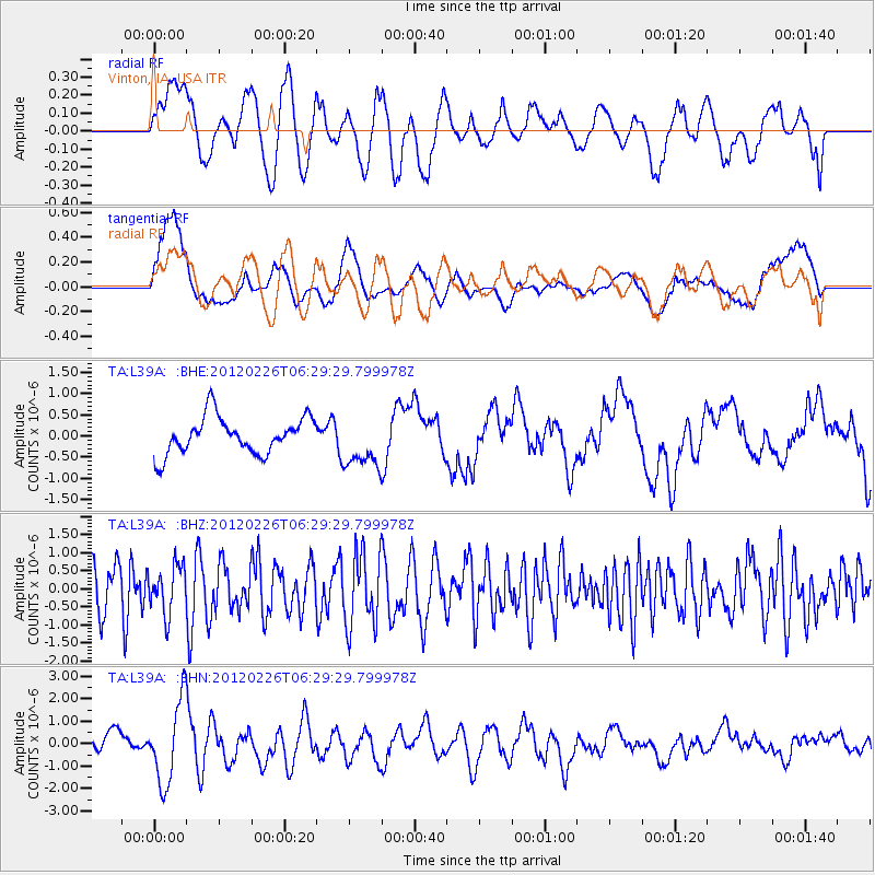
L39A Vinton, IA, USA - Earthquake Result Viewer
*The percent match for this event was below the threshold and hence no stack was calculated.
| Earthquake location: |
Southwestern Siberia, Russia |
| Earthquake latitude/longitude: |
51.7/96.0 |
| Earthquake time(UTC): |
2012/02/26 (057) 06:17:19 GMT |
| Earthquake Depth: |
12 km |
| Earthquake Magnitude: |
6.4 MB, 6.6 MS, 6.7 MW, 6.5 MW |
| Earthquake Catalog/Contributor: |
WHDF/NEIC |
|
| Network: |
TA USArray Transportable Network (new EarthScope stations) |
| Station: |
L39A Vinton, IA, USA |
| Lat/Lon: |
42.12 N/92.00 W |
| Elevation: |
261 m |
|
| Distance: |
86.3 deg |
| Az: |
5.949 deg |
| Baz: |
355.027 deg |
| Ray Param: |
$rayparam |
*The percent match for this event was below the threshold and hence was not used in the summary stack. |
|
| Radial Match: |
60.354446 % |
| Radial Bump: |
400 |
| Transverse Match: |
60.19069 % |
| Transverse Bump: |
400 |
| SOD ConfigId: |
440406 |
| Insert Time: |
2012-05-15 05:22:28.996 +0000 |
| GWidth: |
2.5 |
| Max Bumps: |
400 |
| Tol: |
0.001 |
|
Signal To Noise
| Channel | StoN | STA | LTA |
| TA:L39A: :BHZ:20120226T06:29:29.799978Z | 0.7639875 | 6.4290526E-7 | 8.415128E-7 |
| TA:L39A: :BHN:20120226T06:29:29.799978Z | 3.8885689 | 1.81944E-6 | 4.678945E-7 |
| TA:L39A: :BHE:20120226T06:29:29.799978Z | 1.4276575 | 6.192115E-7 | 4.3372555E-7 |
| Arrivals |
| Ps | |
| PpPs | |
| PsPs/PpSs | |


