
M41A Milan, IL, USA - Earthquake Result Viewer
| ||||||||||||||||||
| ||||||||||||||||||
| ||||||||||||||||||
|
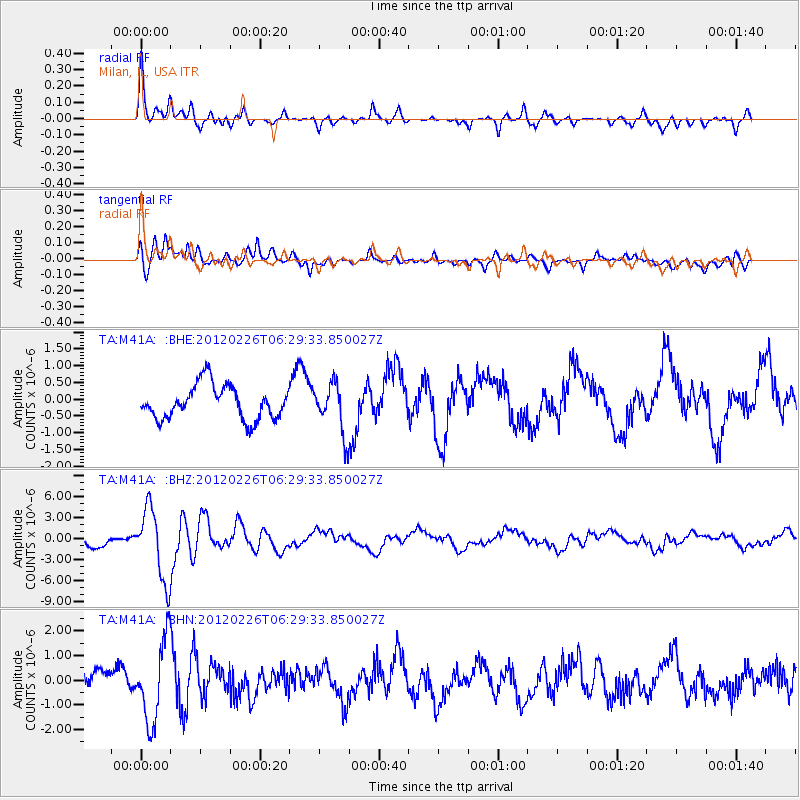
Signal To Noise
| Channel | StoN | STA | LTA |
| TA:M41A: :BHZ:20120226T06:29:33.850027Z | 6.32138 | 5.0848753E-6 | 8.0439327E-7 |
| TA:M41A: :BHN:20120226T06:29:33.850027Z | 3.5154557 | 1.6367107E-6 | 4.6557568E-7 |
| TA:M41A: :BHE:20120226T06:29:33.850027Z | 1.4828846 | 7.3950287E-7 | 4.986921E-7 |
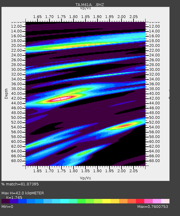
| Arrivals | |
| Ps | 4.9 SECOND |
| PpPs | 17 SECOND |
| PsPs/PpSs | 22 SECOND |

