R43A Red Bud, IL, USA - Earthquake Result Viewer
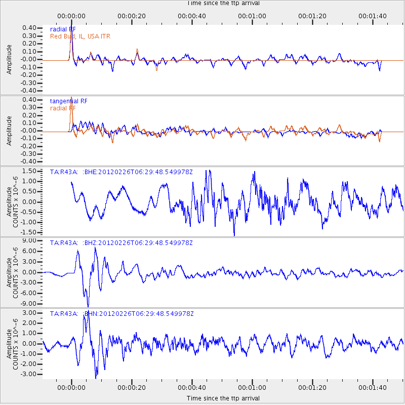
Earthquake location: Southwestern Siberia, Russia
Earthquake latitude/longitude: 51.7/96.0
Earthquake time(UTC): 2012/02/26 (057) 06:17:19 GMT
Earthquake Depth: 12 km
Earthquake Magnitude: 6.4 MB, 6.6 MS, 6.7 MW, 6.5 MW
Earthquake Catalog/Contributor: WHDF/NEIC
Network: TA USArray Transportable Network (new EarthScope stations)
Station: R43A Red Bud, IL, USA
Lat/Lon: 38.28 N/89.93 W
Elevation: 186 m
Distance: 90.2 deg
Az: 4.658 deg
Baz: 356.319 deg
Ray Param: 0.041687135
Estimated Moho Depth: 52.0 km
Estimated Crust Vp/Vs: 1.79
Assumed Crust Vp: 6.444 km/s
Estimated Crust Vs: 3.6 km/s
Estimated Crust Poisson's Ratio: 0.27
Radial Match: 82.877655 %
Radial Bump: 400
Transverse Match: 75.993034 %
Transverse Bump: 400
SOD ConfigId: 440406
Insert Time: 2012-05-15 05:24:53.284 +0000
GWidth: 2.5
Max Bumps: 400
Tol: 0.001

Signal To Noise

ChannelStoNSTALTA
TA:R43A: :BHZ:20120226T06:29:48.549978Z6.09615043.4673067E-65.6876985E-7
TA:R43A: :BHN:20120226T06:29:48.549978Z2.88283661.2347388E-64.283069E-7
TA:R43A: :BHE:20120226T06:29:48.549978Z1.34942536.303353E-74.671139E-7
Arrivals
Ps6.5 SECOND
PpPs22 SECOND
PsPs/PpSs29 SECOND