H41A Junction City, WI, USA - Earthquake Result Viewer
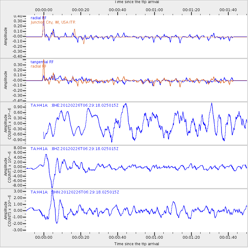
Earthquake location: Southwestern Siberia, Russia
Earthquake latitude/longitude: 51.7/96.0
Earthquake time(UTC): 2012/02/26 (057) 06:17:19 GMT
Earthquake Depth: 12 km
Earthquake Magnitude: 6.4 MB, 6.6 MS, 6.7 MW, 6.5 MW
Earthquake Catalog/Contributor: WHDF/NEIC
Network: TA USArray Transportable Network (new EarthScope stations)
Station: H41A Junction City, WI, USA
Lat/Lon: 44.62 N/89.65 W
Elevation: 348 m
Distance: 83.9 deg
Az: 4.051 deg
Baz: 356.472 deg
Ray Param: 0.045833256
Estimated Moho Depth: 35.25 km
Estimated Crust Vp/Vs: 1.95
Assumed Crust Vp: 6.41 km/s
Estimated Crust Vs: 3.292 km/s
Estimated Crust Poisson's Ratio: 0.32
Radial Match: 83.61665 %
Radial Bump: 400
Transverse Match: 70.4966 %
Transverse Bump: 400
SOD ConfigId: 440406
Insert Time: 2012-05-15 05:25:19.613 +0000
GWidth: 2.5
Max Bumps: 400
Tol: 0.001

Signal To Noise

ChannelStoNSTALTA
TA:H41A: :BHZ:20120226T06:29:18.025015Z7.52254.500641E-65.9829057E-7
TA:H41A: :BHN:20120226T06:29:18.025015Z4.250491.3906713E-63.2717904E-7
TA:H41A: :BHE:20120226T06:29:18.025015Z0.773058653.6709716E-74.7486327E-7
Arrivals
Ps5.3 SECOND
PpPs16 SECOND
PsPs/PpSs21 SECOND