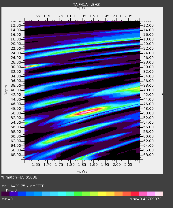
F41A Wisconsin Rapids, WI, USA - Earthquake Result Viewer
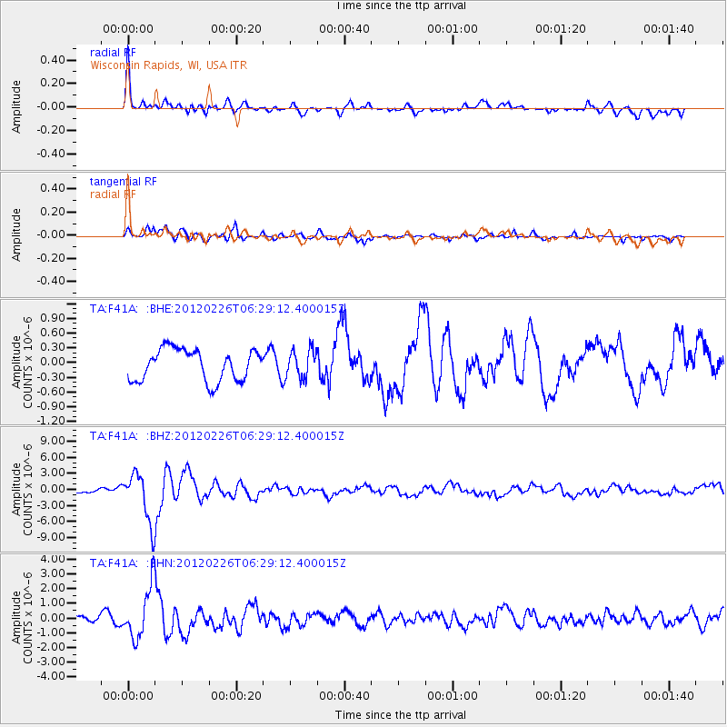
Earthquake location: Southwestern Siberia, Russia
Earthquake latitude/longitude: 51.7/96.0
Earthquake time(UTC): 2012/02/26 (057) 06:17:19 GMT
Earthquake Depth: 12 km
Earthquake Magnitude: 6.4 MB, 6.6 MS, 6.7 MW, 6.5 MW
Earthquake Catalog/Contributor: WHDF/NEIC
Network: TA USArray Transportable Network (new EarthScope stations)
Station: F41A Wisconsin Rapids, WI, USA
Lat/Lon: 45.74 N/89.10 W
Elevation: 509 m
Distance: 82.8 deg
Az: 3.594 deg
Baz: 356.807 deg
Ray Param: 0.046608962
Estimated Moho Depth: 29.75 km
Estimated Crust Vp/Vs: 1.60
Assumed Crust Vp: 6.41 km/s
Estimated Crust Vs: 4.006 km/s
Estimated Crust Poisson's Ratio: 0.18
Radial Match: 85.05636 %
Radial Bump: 400
Transverse Match: 82.554436 %
Transverse Bump: 400
SOD ConfigId: 440406
Insert Time: 2012-05-15 05:27:02.076 +0000
GWidth: 2.5
Max Bumps: 400
Tol: 0.001

Signal To Noise

ChannelStoNSTALTA
TA:F41A: :BHZ:20120226T06:29:12.400015Z7.4045724.6803157E-66.320846E-7
TA:F41A: :BHN:20120226T06:29:12.400015Z5.1097811.7650364E-63.454231E-7
TA:F41A: :BHE:20120226T06:29:12.400015Z0.884432262.8244023E-73.1934636E-7
Arrivals
Ps2.9 SECOND
PpPs12 SECOND
PsPs/PpSs15 SECOND