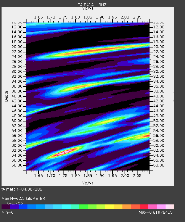
E41A Kenton, MI, USA - Earthquake Result Viewer
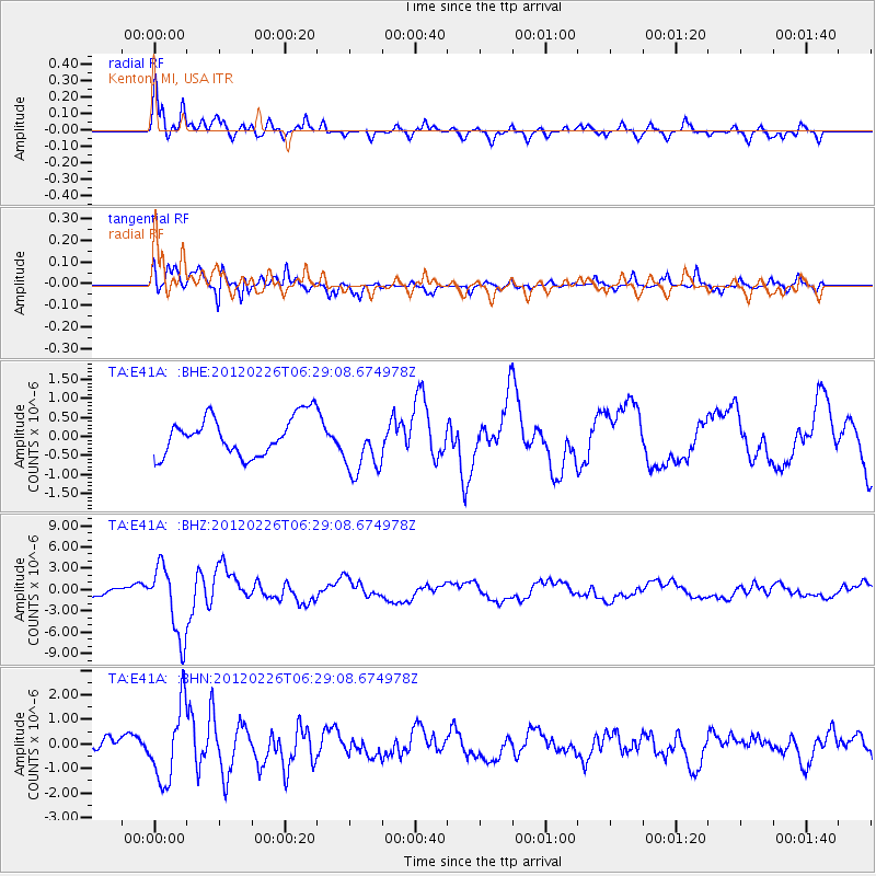
Earthquake location: Southwestern Siberia, Russia
Earthquake latitude/longitude: 51.7/96.0
Earthquake time(UTC): 2012/02/26 (057) 06:17:19 GMT
Earthquake Depth: 12 km
Earthquake Magnitude: 6.4 MB, 6.6 MS, 6.7 MW, 6.5 MW
Earthquake Catalog/Contributor: WHDF/NEIC
Network: TA USArray Transportable Network (new EarthScope stations)
Station: E41A Kenton, MI, USA
Lat/Lon: 46.46 N/88.96 W
Elevation: 377 m
Distance: 82.1 deg
Az: 3.455 deg
Baz: 356.89 deg
Ray Param: 0.047108095
Estimated Moho Depth: 62.5 km
Estimated Crust Vp/Vs: 1.75
Assumed Crust Vp: 6.467 km/s
Estimated Crust Vs: 3.685 km/s
Estimated Crust Poisson's Ratio: 0.26
Radial Match: 84.007286 %
Radial Bump: 400
Transverse Match: 83.73083 %
Transverse Bump: 390
SOD ConfigId: 440406
Insert Time: 2012-05-15 05:27:29.672 +0000
GWidth: 2.5
Max Bumps: 400
Tol: 0.001

Signal To Noise

ChannelStoNSTALTA
TA:E41A: :BHZ:20120226T06:29:08.674978Z9.48965555.0122258E-65.2817785E-7
TA:E41A: :BHN:20120226T06:29:08.674978Z3.74353151.5170122E-64.052356E-7
TA:E41A: :BHE:20120226T06:29:08.674978Z1.5747067.881298E-75.004933E-7
Arrivals
Ps7.5 SECOND
PpPs26 SECOND
PsPs/PpSs33 SECOND