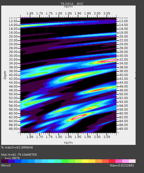
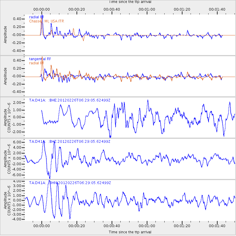
D41A Chassel, MI, USA - Earthquake Result Viewer

Earthquake location: Southwestern Siberia, Russia
Earthquake latitude/longitude: 51.7/96.0
Earthquake time(UTC): 2012/02/26 (057) 06:17:19 GMT
Earthquake Depth: 12 km
Earthquake Magnitude: 6.4 MB, 6.6 MS, 6.7 MW, 6.5 MW
Earthquake Catalog/Contributor: WHDF/NEIC
Network: TA USArray Transportable Network (new EarthScope stations)
Station: D41A Chassel, MI, USA
Lat/Lon: 47.06 N/88.57 W
Elevation: 271 m
Distance: 81.5 deg
Az: 3.148 deg
Baz: 357.135 deg
Ray Param: 0.047516294
Estimated Moho Depth: 61.75 km
Estimated Crust Vp/Vs: 1.90
Assumed Crust Vp: 6.467 km/s
Estimated Crust Vs: 3.408 km/s
Estimated Crust Poisson's Ratio: 0.31
Radial Match: 82.699646 %
Radial Bump: 348
Transverse Match: 79.55217 %
Transverse Bump: 400
SOD ConfigId: 440406
Insert Time: 2012-05-15 05:27:39.573 +0000
GWidth: 2.5
Max Bumps: 400
Tol: 0.001

Signal To Noise

ChannelStoNSTALTA
TA:D41A: :BHZ:20120226T06:29:05.62499Z4.4385344.3156956E-69.723245E-7
TA:D41A: :BHN:20120226T06:29:05.62499Z4.5121592.2692686E-65.0292306E-7
TA:D41A: :BHE:20120226T06:29:05.62499Z1.08852299.425223E-78.658728E-7
Arrivals
Ps8.8 SECOND
PpPs27 SECOND
PsPs/PpSs36 SECOND