
L43A Garden Prairie, IL, USA - Earthquake Result Viewer
| ||||||||||||||||||
| ||||||||||||||||||
| ||||||||||||||||||
|
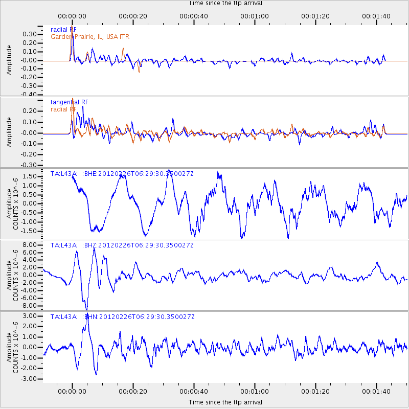
Signal To Noise
| Channel | StoN | STA | LTA |
| TA:L43A: :BHZ:20120226T06:29:30.350027Z | 4.6745296 | 4.862262E-6 | 1.0401607E-6 |
| TA:L43A: :BHN:20120226T06:29:30.350027Z | 3.990559 | 1.3653466E-6 | 3.4214418E-7 |
| TA:L43A: :BHE:20120226T06:29:30.350027Z | 0.9966445 | 1.0473492E-6 | 1.0508753E-6 |
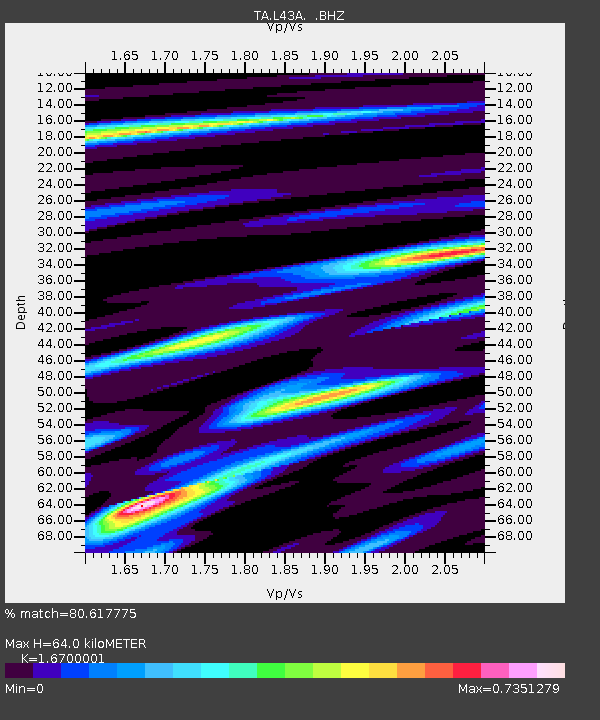
| Arrivals | |
| Ps | 6.7 SECOND |
| PpPs | 25 SECOND |
| PsPs/PpSs | 32 SECOND |

