You are here: Home > Network List > TA - USArray Transportable Network (new EarthScope stations) Stations List
> Station L44A Lake County Forest Preserve, Grayslake, IL, USA > Earthquake Result Viewer
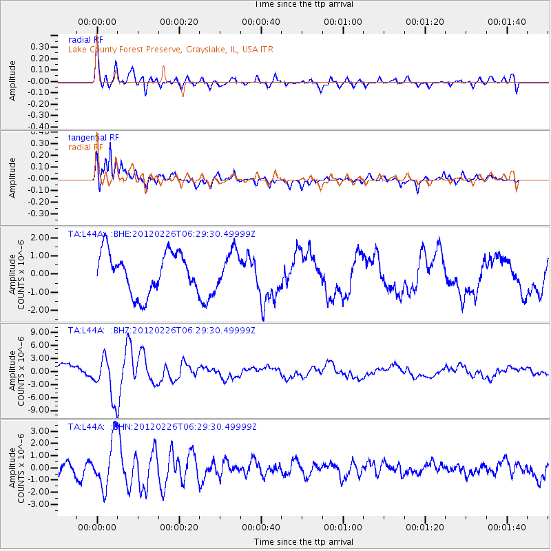
L44A Lake County Forest Preserve, Grayslake, IL, USA - Earthquake Result Viewer
*The percent match for this event was below the threshold and hence no stack was calculated.
| Earthquake location: |
Southwestern Siberia, Russia |
| Earthquake latitude/longitude: |
51.7/96.0 |
| Earthquake time(UTC): |
2012/02/26 (057) 06:17:19 GMT |
| Earthquake Depth: |
12 km |
| Earthquake Magnitude: |
6.4 MB, 6.6 MS, 6.7 MW, 6.5 MW |
| Earthquake Catalog/Contributor: |
WHDF/NEIC |
|
| Network: |
TA USArray Transportable Network (new EarthScope stations) |
| Station: |
L44A Lake County Forest Preserve, Grayslake, IL, USA |
| Lat/Lon: |
42.18 N/87.91 W |
| Elevation: |
202 m |
|
| Distance: |
86.4 deg |
| Az: |
2.906 deg |
| Baz: |
357.568 deg |
| Ray Param: |
$rayparam |
*The percent match for this event was below the threshold and hence was not used in the summary stack. |
|
| Radial Match: |
78.60106 % |
| Radial Bump: |
400 |
| Transverse Match: |
86.35316 % |
| Transverse Bump: |
400 |
| SOD ConfigId: |
440406 |
| Insert Time: |
2012-05-15 05:29:21.290 +0000 |
| GWidth: |
2.5 |
| Max Bumps: |
400 |
| Tol: |
0.001 |
|
Signal To Noise
| Channel | StoN | STA | LTA |
| TA:L44A: :BHZ:20120226T06:29:30.49999Z | 3.301004 | 4.8557813E-6 | 1.4710014E-6 |
| TA:L44A: :BHN:20120226T06:29:30.49999Z | 5.1119037 | 2.0597724E-6 | 4.029365E-7 |
| TA:L44A: :BHE:20120226T06:29:30.49999Z | 0.8587369 | 9.568232E-7 | 1.1142217E-6 |
| Arrivals |
| Ps | |
| PpPs | |
| PsPs/PpSs | |


