
N45A Kentland, IN, USA - Earthquake Result Viewer
| ||||||||||||||||||
| ||||||||||||||||||
| ||||||||||||||||||
|
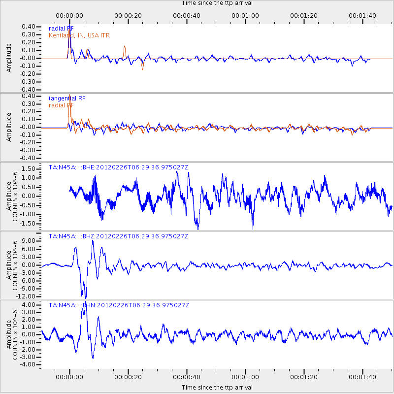
Signal To Noise
| Channel | StoN | STA | LTA |
| TA:N45A: :BHZ:20120226T06:29:36.975027Z | 8.879524 | 4.8003826E-6 | 5.406126E-7 |
| TA:N45A: :BHN:20120226T06:29:36.975027Z | 3.6464124 | 1.5806949E-6 | 4.3349317E-7 |
| TA:N45A: :BHE:20120226T06:29:36.975027Z | 0.76464343 | 3.6112172E-7 | 4.7227465E-7 |
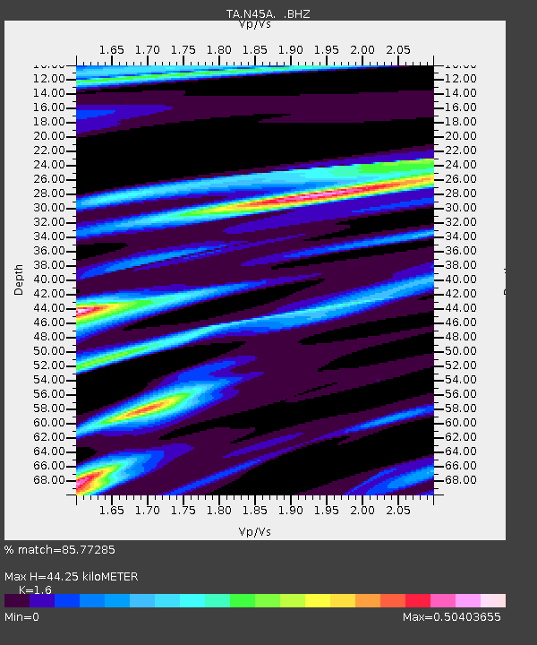
| Arrivals | |
| Ps | 4.2 SECOND |
| PpPs | 17 SECOND |
| PsPs/PpSs | 21 SECOND |

