N46A Monticello, IN, USA - Earthquake Result Viewer
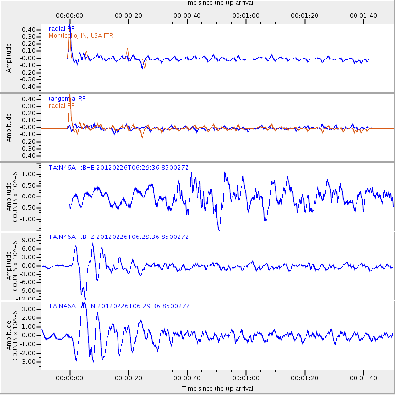
Earthquake location: Southwestern Siberia, Russia
Earthquake latitude/longitude: 51.7/96.0
Earthquake time(UTC): 2012/02/26 (057) 06:17:19 GMT
Earthquake Depth: 12 km
Earthquake Magnitude: 6.4 MB, 6.6 MS, 6.7 MW, 6.5 MW
Earthquake Catalog/Contributor: WHDF/NEIC
Network: TA USArray Transportable Network (new EarthScope stations)
Station: N46A Monticello, IN, USA
Lat/Lon: 40.89 N/86.74 W
Elevation: 209 m
Distance: 87.7 deg
Az: 2.068 deg
Baz: 358.303 deg
Ray Param: 0.043098908
Estimated Moho Depth: 49.0 km
Estimated Crust Vp/Vs: 1.66
Assumed Crust Vp: 6.498 km/s
Estimated Crust Vs: 3.902 km/s
Estimated Crust Poisson's Ratio: 0.22
Radial Match: 93.869896 %
Radial Bump: 344
Transverse Match: 82.440735 %
Transverse Bump: 400
SOD ConfigId: 440406
Insert Time: 2012-05-15 05:29:34.625 +0000
GWidth: 2.5
Max Bumps: 400
Tol: 0.001

Signal To Noise

ChannelStoNSTALTA
TA:N46A: :BHZ:20120226T06:29:36.850027Z9.887664.8243814E-64.879194E-7
TA:N46A: :BHN:20120226T06:29:36.850027Z5.8947851.8602174E-63.1557002E-7
TA:N46A: :BHE:20120226T06:29:36.850027Z0.998524962.784642E-72.7887558E-7
Arrivals
Ps5.1 SECOND
PpPs20 SECOND
PsPs/PpSs25 SECOND