
INU Inuyama, Japan - Earthquake Result Viewer
| ||||||||||||||||||
| ||||||||||||||||||
| ||||||||||||||||||
|
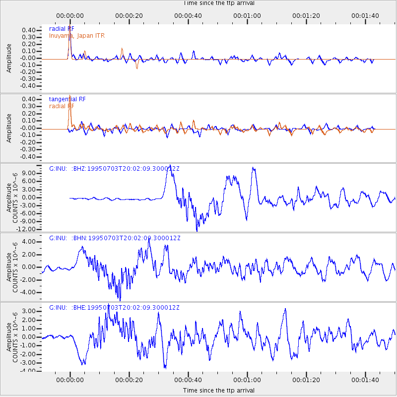
Signal To Noise
| Channel | StoN | STA | LTA |
| G:INU: :BHN:19950703T20:02:09.300012Z | 7.1225796 | 1.8155721E-6 | 2.5490374E-7 |
| G:INU: :BHE:19950703T20:02:09.300012Z | 13.355763 | 1.742256E-6 | 1.3044975E-7 |
| G:INU: :BHZ:19950703T20:02:09.300012Z | 27.33349 | 6.9382404E-6 | 2.5383662E-7 |
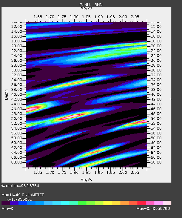
| Arrivals | |
| Ps | 6.1 SECOND |
| PpPs | 20 SECOND |
| PsPs/PpSs | 27 SECOND |

