
T47A Sharon Grove, KY, USA - Earthquake Result Viewer
| ||||||||||||||||||
| ||||||||||||||||||
| ||||||||||||||||||
|
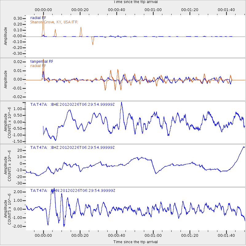
Signal To Noise
| Channel | StoN | STA | LTA |
| TA:T47A: :BHZ:20120226T06:29:54.99999Z | 0.9438335 | 5.0599683E-5 | 5.361082E-5 |
| TA:T47A: :BHN:20120226T06:29:54.99999Z | 1.3524199 | 1.2690457E-6 | 9.3835183E-7 |
| TA:T47A: :BHE:20120226T06:29:54.99999Z | 1.2093866 | 7.1059065E-7 | 5.875629E-7 |
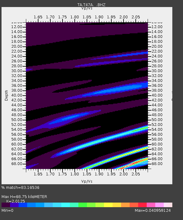
| Arrivals | |
| Ps | 11 SECOND |
| PpPs | 32 SECOND |
| PsPs/PpSs | 43 SECOND |

