
U46A Springville, TN, USA - Earthquake Result Viewer
| ||||||||||||||||||
| ||||||||||||||||||
| ||||||||||||||||||
|
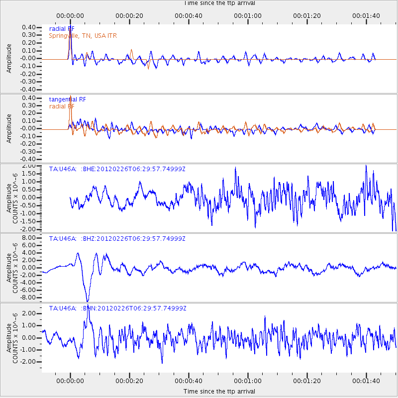
Signal To Noise
| Channel | StoN | STA | LTA |
| TA:U46A: :BHZ:20120226T06:29:57.74999Z | 4.0133204 | 2.4663498E-6 | 6.1454097E-7 |
| TA:U46A: :BHN:20120226T06:29:57.74999Z | 2.3695524 | 7.791089E-7 | 3.288E-7 |
| TA:U46A: :BHE:20120226T06:29:57.74999Z | 0.8604268 | 3.746092E-7 | 4.3537602E-7 |
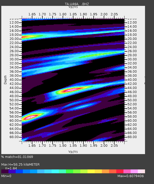
| Arrivals | |
| Ps | 5.9 SECOND |
| PpPs | 23 SECOND |
| PsPs/PpSs | 29 SECOND |

