You are here: Home > Network List > WY - Yellowstone Wyoming Seismic Network Stations List
> Station YHH Holmes Hill, YNP, WY, USA > Earthquake Result Viewer
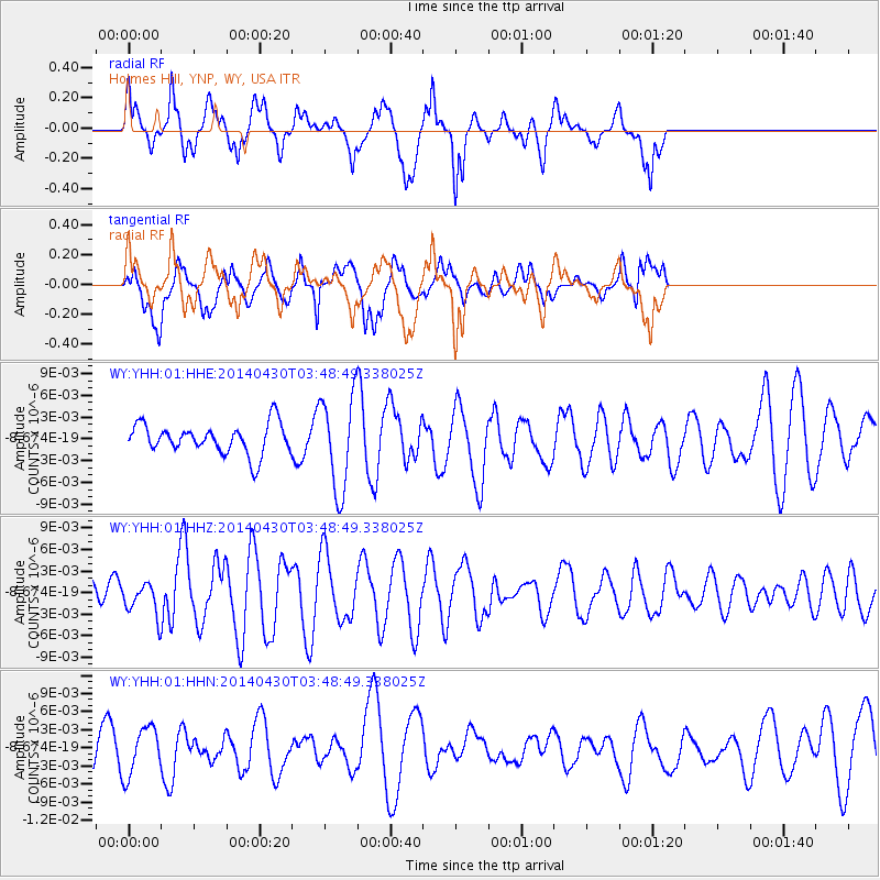
YHH Holmes Hill, YNP, WY, USA - Earthquake Result Viewer
*The percent match for this event was below the threshold and hence no stack was calculated.
| Earthquake location: |
Tonga Islands Region |
| Earthquake latitude/longitude: |
-23.5/-175.5 |
| Earthquake time(UTC): |
2014/04/30 (120) 03:36:23 GMT |
| Earthquake Depth: |
20 km |
| Earthquake Magnitude: |
5.3 MW |
| Earthquake Catalog/Contributor: |
ISC/ISC |
|
| Network: |
WY Yellowstone Wyoming Seismic Network |
| Station: |
YHH Holmes Hill, YNP, WY, USA |
| Lat/Lon: |
44.79 N/110.85 W |
| Elevation: |
2717 m |
|
| Distance: |
89.9 deg |
| Az: |
40.071 deg |
| Baz: |
236.121 deg |
| Ray Param: |
$rayparam |
*The percent match for this event was below the threshold and hence was not used in the summary stack. |
|
| Radial Match: |
68.74555 % |
| Radial Bump: |
400 |
| Transverse Match: |
49.718323 % |
| Transverse Bump: |
400 |
| SOD ConfigId: |
3390531 |
| Insert Time: |
2019-04-11 15:32:34.446 +0000 |
| GWidth: |
2.5 |
| Max Bumps: |
400 |
| Tol: |
0.001 |
|
Signal To Noise
| Channel | StoN | STA | LTA |
| WY:YHH:01:HHZ:20140430T03:48:49.338025Z | 0.75950897 | 2.1501225E-9 | 2.8309377E-9 |
| WY:YHH:01:HHN:20140430T03:48:49.338025Z | 1.5593653 | 4.0346007E-9 | 2.5873352E-9 |
| WY:YHH:01:HHE:20140430T03:48:49.338025Z | 3.1398993 | 6.453183E-9 | 2.0552198E-9 |
| Arrivals |
| Ps | |
| PpPs | |
| PsPs/PpSs | |


