You are here: Home > Network List > CI - Caltech Regional Seismic Network Stations List
> Station SWS Sam W. Stewart, Westmorland, CA, USA > Earthquake Result Viewer
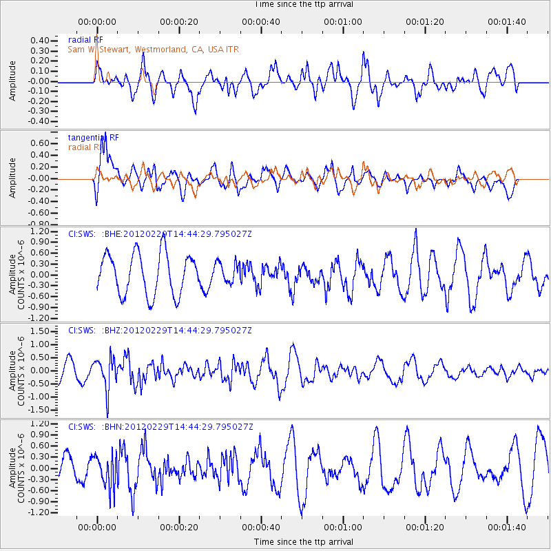
SWS Sam W. Stewart, Westmorland, CA, USA - Earthquake Result Viewer
*The percent match for this event was below the threshold and hence no stack was calculated.
| Earthquake location: |
Near East Coast Of Honshu, Japan |
| Earthquake latitude/longitude: |
35.2/141.0 |
| Earthquake time(UTC): |
2012/02/29 (060) 14:32:47 GMT |
| Earthquake Depth: |
26 km |
| Earthquake Magnitude: |
5.6 MB, 5.5 MS, 5.6 MW, 5.7 MW |
| Earthquake Catalog/Contributor: |
WHDF/NEIC |
|
| Network: |
CI Caltech Regional Seismic Network |
| Station: |
SWS Sam W. Stewart, Westmorland, CA, USA |
| Lat/Lon: |
32.94 N/115.80 W |
| Elevation: |
140 m |
|
| Distance: |
81.2 deg |
| Az: |
55.94 deg |
| Baz: |
306.211 deg |
| Ray Param: |
$rayparam |
*The percent match for this event was below the threshold and hence was not used in the summary stack. |
|
| Radial Match: |
58.326054 % |
| Radial Bump: |
400 |
| Transverse Match: |
69.9108 % |
| Transverse Bump: |
400 |
| SOD ConfigId: |
440406 |
| Insert Time: |
2012-05-15 06:02:18.430 +0000 |
| GWidth: |
2.5 |
| Max Bumps: |
400 |
| Tol: |
0.001 |
|
Signal To Noise
| Channel | StoN | STA | LTA |
| CI:SWS: :BHZ:20120229T14:44:29.795027Z | 2.0238662 | 6.0684505E-7 | 2.9984443E-7 |
| CI:SWS: :BHN:20120229T14:44:29.795027Z | 0.84011793 | 4.2114462E-7 | 5.012923E-7 |
| CI:SWS: :BHE:20120229T14:44:29.795027Z | 0.48860192 | 2.7654858E-7 | 5.659998E-7 |
| Arrivals |
| Ps | |
| PpPs | |
| PsPs/PpSs | |


