You are here: Home > Network List > IU - Global Seismograph Network (GSN - IRIS/USGS) Stations List
> Station PMG Port Moresby, New Guinea > Earthquake Result Viewer
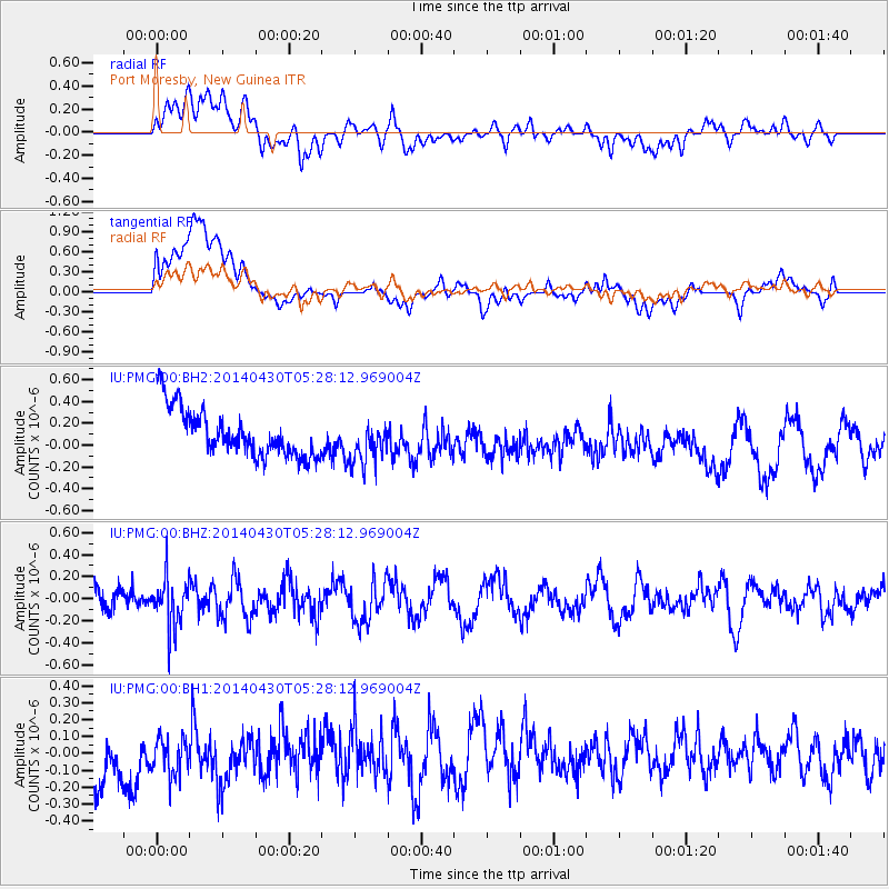
PMG Port Moresby, New Guinea - Earthquake Result Viewer
*The percent match for this event was below the threshold and hence no stack was calculated.
| Earthquake location: |
South Of Kermadec Islands |
| Earthquake latitude/longitude: |
-33.0/-178.9 |
| Earthquake time(UTC): |
2014/04/30 (120) 05:21:20 GMT |
| Earthquake Depth: |
45 km |
| Earthquake Magnitude: |
5.1 MW |
| Earthquake Catalog/Contributor: |
ISC/ISC |
|
| Network: |
IU Global Seismograph Network (GSN - IRIS/USGS) |
| Station: |
PMG Port Moresby, New Guinea |
| Lat/Lon: |
9.40 S/147.16 E |
| Elevation: |
90 m |
|
| Distance: |
39.1 deg |
| Az: |
299.096 deg |
| Baz: |
131.879 deg |
| Ray Param: |
$rayparam |
*The percent match for this event was below the threshold and hence was not used in the summary stack. |
|
| Radial Match: |
59.726612 % |
| Radial Bump: |
400 |
| Transverse Match: |
40.770386 % |
| Transverse Bump: |
400 |
| SOD ConfigId: |
3390531 |
| Insert Time: |
2019-04-11 15:35:12.000 +0000 |
| GWidth: |
2.5 |
| Max Bumps: |
400 |
| Tol: |
0.001 |
|
Signal To Noise
| Channel | StoN | STA | LTA |
| IU:PMG:00:BHZ:20140430T05:28:12.969004Z | 1.7890633 | 2.2469662E-7 | 1.2559455E-7 |
| IU:PMG:00:BH1:20140430T05:28:12.969004Z | 0.6081721 | 2.0754797E-7 | 3.4126518E-7 |
| IU:PMG:00:BH2:20140430T05:28:12.969004Z | 0.91156876 | 1.9900224E-7 | 2.1830745E-7 |
| Arrivals |
| Ps | |
| PpPs | |
| PsPs/PpSs | |


