You are here: Home > Network List > TA - USArray Transportable Network (new EarthScope stations) Stations List
> Station O47A Sheridan, IN, USA > Earthquake Result Viewer
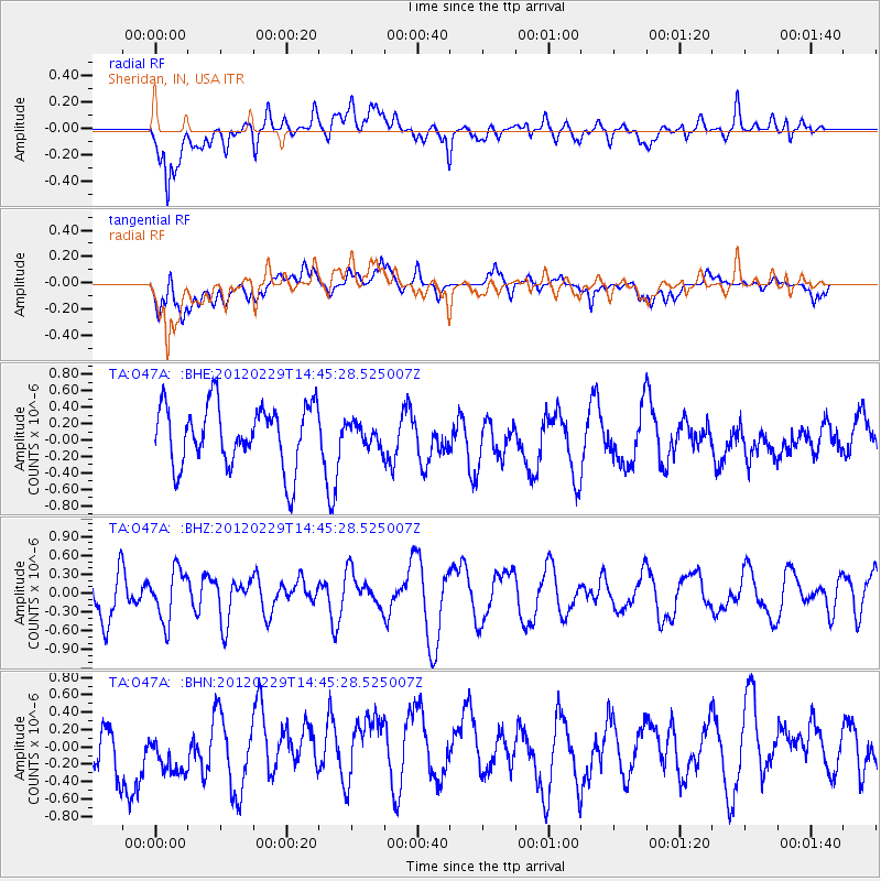
O47A Sheridan, IN, USA - Earthquake Result Viewer
*The percent match for this event was below the threshold and hence no stack was calculated.
| Earthquake location: |
Near East Coast Of Honshu, Japan |
| Earthquake latitude/longitude: |
35.2/141.0 |
| Earthquake time(UTC): |
2012/02/29 (060) 14:32:47 GMT |
| Earthquake Depth: |
26 km |
| Earthquake Magnitude: |
5.6 MB, 5.5 MS, 5.6 MW, 5.7 MW |
| Earthquake Catalog/Contributor: |
WHDF/NEIC |
|
| Network: |
TA USArray Transportable Network (new EarthScope stations) |
| Station: |
O47A Sheridan, IN, USA |
| Lat/Lon: |
40.24 N/86.17 W |
| Elevation: |
278 m |
|
| Distance: |
93.3 deg |
| Az: |
34.22 deg |
| Baz: |
323.013 deg |
| Ray Param: |
$rayparam |
*The percent match for this event was below the threshold and hence was not used in the summary stack. |
|
| Radial Match: |
58.4494 % |
| Radial Bump: |
400 |
| Transverse Match: |
32.07665 % |
| Transverse Bump: |
400 |
| SOD ConfigId: |
440406 |
| Insert Time: |
2012-05-15 06:13:37.036 +0000 |
| GWidth: |
2.5 |
| Max Bumps: |
400 |
| Tol: |
0.001 |
|
Signal To Noise
| Channel | StoN | STA | LTA |
| TA:O47A: :BHZ:20120229T14:45:28.525007Z | 1.1225463 | 4.0044424E-7 | 3.5672846E-7 |
| TA:O47A: :BHN:20120229T14:45:28.525007Z | 1.2101479 | 3.8932566E-7 | 3.2171744E-7 |
| TA:O47A: :BHE:20120229T14:45:28.525007Z | 0.3576375 | 1.3514163E-7 | 3.778732E-7 |
| Arrivals |
| Ps | |
| PpPs | |
| PsPs/PpSs | |


