You are here: Home > Network List > TA - USArray Transportable Network (new EarthScope stations) Stations List
> Station V47A Nunnelly, TN, USA > Earthquake Result Viewer
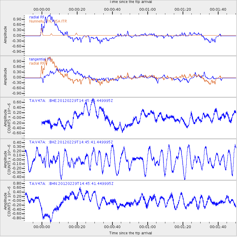
V47A Nunnelly, TN, USA - Earthquake Result Viewer
*The percent match for this event was below the threshold and hence no stack was calculated.
| Earthquake location: |
Near East Coast Of Honshu, Japan |
| Earthquake latitude/longitude: |
35.2/141.0 |
| Earthquake time(UTC): |
2012/02/29 (060) 14:32:47 GMT |
| Earthquake Depth: |
26 km |
| Earthquake Magnitude: |
5.6 MB, 5.5 MS, 5.6 MW, 5.7 MW |
| Earthquake Catalog/Contributor: |
WHDF/NEIC |
|
| Network: |
TA USArray Transportable Network (new EarthScope stations) |
| Station: |
V47A Nunnelly, TN, USA |
| Lat/Lon: |
35.83 N/87.52 W |
| Elevation: |
240 m |
|
| Distance: |
96.1 deg |
| Az: |
37.757 deg |
| Baz: |
321.897 deg |
| Ray Param: |
$rayparam |
*The percent match for this event was below the threshold and hence was not used in the summary stack. |
|
| Radial Match: |
65.4884 % |
| Radial Bump: |
400 |
| Transverse Match: |
59.493603 % |
| Transverse Bump: |
400 |
| SOD ConfigId: |
440406 |
| Insert Time: |
2012-05-15 06:13:59.058 +0000 |
| GWidth: |
2.5 |
| Max Bumps: |
400 |
| Tol: |
0.001 |
|
Signal To Noise
| Channel | StoN | STA | LTA |
| TA:V47A: :BHZ:20120229T14:45:41.449995Z | 0.6557542 | 1.3760229E-7 | 2.0983819E-7 |
| TA:V47A: :BHN:20120229T14:45:41.449995Z | 3.9564362 | 7.454911E-7 | 1.884249E-7 |
| TA:V47A: :BHE:20120229T14:45:41.449995Z | 2.2368155 | 4.9669353E-7 | 2.2205388E-7 |
| Arrivals |
| Ps | |
| PpPs | |
| PsPs/PpSs | |


