
INU Inuyama, Japan - Earthquake Result Viewer
| ||||||||||||||||||
| ||||||||||||||||||
| ||||||||||||||||||
|
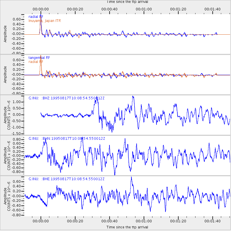
Signal To Noise
| Channel | StoN | STA | LTA |
| G:INU: :BHN:19950817T10:08:54.550012Z | 7.577537 | 4.3564606E-7 | 5.7491775E-8 |
| G:INU: :BHE:19950817T10:08:54.550012Z | 4.874637 | 2.2586373E-7 | 4.633447E-8 |
| G:INU: :BHZ:19950817T10:08:54.550012Z | 11.353502 | 7.908393E-7 | 6.9655975E-8 |
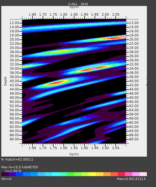
| Arrivals | |
| Ps | 3.3 SECOND |
| PpPs | 8.4 SECOND |
| PsPs/PpSs | 12 SECOND |

