
INU Inuyama, Japan - Earthquake Result Viewer
| ||||||||||||||||||
| ||||||||||||||||||
| ||||||||||||||||||
|
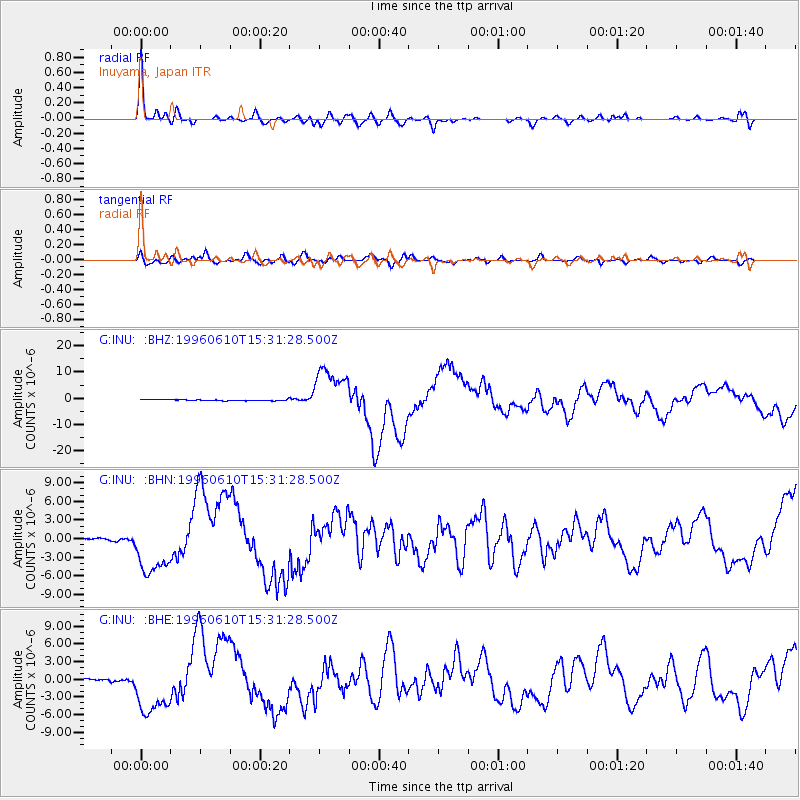
Signal To Noise
| Channel | StoN | STA | LTA |
| G:INU: :BHN:19960610T15:31:28.500Z | 30.382307 | 4.4299654E-6 | 1.458074E-7 |
| G:INU: :BHE:19960610T15:31:28.500Z | 35.125816 | 4.618312E-6 | 1.3147914E-7 |
| G:INU: :BHZ:19960610T15:31:28.500Z | 43.686523 | 9.064165E-6 | 2.0748195E-7 |
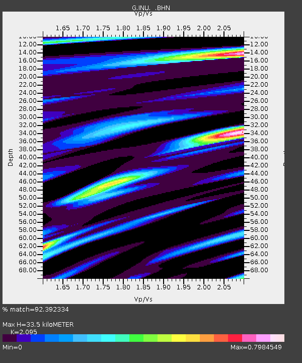
| Arrivals | |
| Ps | 6.0 SECOND |
| PpPs | 15 SECOND |
| PsPs/PpSs | 21 SECOND |

