You are here: Home > Network List > AZ - ANZA Regional Network Stations List
> Station SMER AZ.SMER > Earthquake Result Viewer
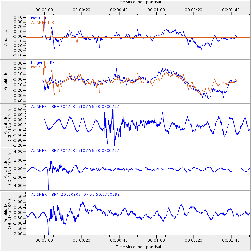
SMER AZ.SMER - Earthquake Result Viewer
*The percent match for this event was below the threshold and hence no stack was calculated.
| Earthquake location: |
Santiago Del Estero Prov., Arg. |
| Earthquake latitude/longitude: |
-28.2/-63.3 |
| Earthquake time(UTC): |
2012/03/05 (065) 07:46:10 GMT |
| Earthquake Depth: |
554 km |
| Earthquake Magnitude: |
6.0 MB, 6.1 MW, 6.1 MW |
| Earthquake Catalog/Contributor: |
WHDF/NEIC |
|
| Network: |
AZ ANZA Regional Network |
| Station: |
SMER AZ.SMER |
| Lat/Lon: |
33.46 N/117.17 W |
| Elevation: |
355 m |
|
| Distance: |
79.8 deg |
| Az: |
316.683 deg |
| Baz: |
133.615 deg |
| Ray Param: |
$rayparam |
*The percent match for this event was below the threshold and hence was not used in the summary stack. |
|
| Radial Match: |
54.027122 % |
| Radial Bump: |
400 |
| Transverse Match: |
54.489014 % |
| Transverse Bump: |
400 |
| SOD ConfigId: |
440406 |
| Insert Time: |
2012-05-19 23:43:59.227 +0000 |
| GWidth: |
2.5 |
| Max Bumps: |
400 |
| Tol: |
0.001 |
|
Signal To Noise
| Channel | StoN | STA | LTA |
| AZ:SMER: :BHZ:20120305T07:56:50.070029Z | 3.921215 | 1.3535401E-6 | 3.4518385E-7 |
| AZ:SMER: :BHN:20120305T07:56:50.070029Z | 1.9676546 | 7.377734E-7 | 3.7495067E-7 |
| AZ:SMER: :BHE:20120305T07:56:50.070029Z | 1.6128987 | 4.122216E-7 | 2.555781E-7 |
| Arrivals |
| Ps | |
| PpPs | |
| PsPs/PpSs | |


