INU Inuyama, Japan - Earthquake Result Viewer
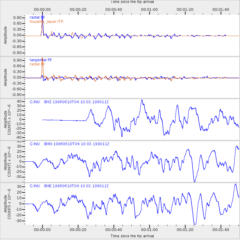
Earthquake location: Andreanof Islands, Aleutian Is.
Earthquake latitude/longitude: 51.6/-177.6
Earthquake time(UTC): 1996/06/10 (162) 04:03:35 GMT
Earthquake Depth: 33 km
Earthquake Magnitude: 6.6 MB, 7.6 MS, 7.9 UNKNOWN, 7.4 MS
Earthquake Catalog/Contributor: WHDF/NEIC
Network: G GEOSCOPE
Station: INU Inuyama, Japan
Lat/Lon: 35.35 N/137.03 E
Elevation: 132 m
Distance: 36.0 deg
Az: 261.26 deg
Baz: 49.001 deg
Ray Param: 0.076838836
Estimated Moho Depth: 49.5 km
Estimated Crust Vp/Vs: 1.64
Assumed Crust Vp: 6.461 km/s
Estimated Crust Vs: 3.94 km/s
Estimated Crust Poisson's Ratio: 0.20
Radial Match: 93.24449 %
Radial Bump: 400
Transverse Match: 72.2444 %
Transverse Bump: 400
SOD ConfigId: 6273
Insert Time: 2010-02-26 23:15:49.599 +0000
GWidth: 2.5
Max Bumps: 400
Tol: 0.001

Signal To Noise

ChannelStoNSTALTA
G:INU: :BHN:19960610T04:10:03.199011Z9.9179133.270136E-63.2972017E-7
G:INU: :BHE:19960610T04:10:03.199011Z8.4948213.2276216E-63.7995173E-7
G:INU: :BHZ:19960610T04:10:03.199011Z13.6583797.6500355E-65.6009833E-7
Arrivals
Ps5.3 SECOND
PpPs19 SECOND
PsPs/PpSs24 SECOND