You are here: Home > Network List > TA - USArray Transportable Network (new EarthScope stations) Stations List
> Station N35A Tabor, IA, USA > Earthquake Result Viewer
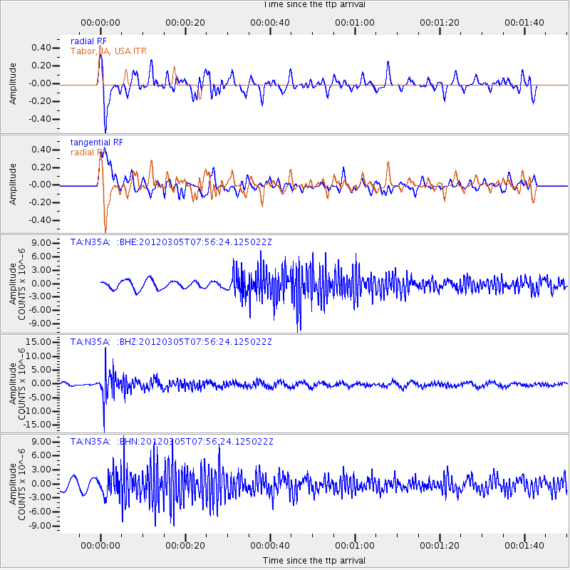
N35A Tabor, IA, USA - Earthquake Result Viewer
*The percent match for this event was below the threshold and hence no stack was calculated.
| Earthquake location: |
Santiago Del Estero Prov., Arg. |
| Earthquake latitude/longitude: |
-28.2/-63.3 |
| Earthquake time(UTC): |
2012/03/05 (065) 07:46:10 GMT |
| Earthquake Depth: |
554 km |
| Earthquake Magnitude: |
6.0 MB, 6.1 MW, 6.1 MW |
| Earthquake Catalog/Contributor: |
WHDF/NEIC |
|
| Network: |
TA USArray Transportable Network (new EarthScope stations) |
| Station: |
N35A Tabor, IA, USA |
| Lat/Lon: |
40.86 N/95.64 W |
| Elevation: |
353 m |
|
| Distance: |
75.0 deg |
| Az: |
335.159 deg |
| Baz: |
150.747 deg |
| Ray Param: |
$rayparam |
*The percent match for this event was below the threshold and hence was not used in the summary stack. |
|
| Radial Match: |
58.832695 % |
| Radial Bump: |
400 |
| Transverse Match: |
60.942997 % |
| Transverse Bump: |
400 |
| SOD ConfigId: |
440406 |
| Insert Time: |
2012-05-19 23:57:50.667 +0000 |
| GWidth: |
2.5 |
| Max Bumps: |
400 |
| Tol: |
0.001 |
|
Signal To Noise
| Channel | StoN | STA | LTA |
| TA:N35A: :BHZ:20120305T07:56:24.125022Z | 5.8330965 | 4.831419E-6 | 8.282769E-7 |
| TA:N35A: :BHN:20120305T07:56:24.125022Z | 2.4544578 | 2.2852473E-6 | 9.3105996E-7 |
| TA:N35A: :BHE:20120305T07:56:24.125022Z | 2.4327357 | 2.259838E-6 | 9.289287E-7 |
| Arrivals |
| Ps | |
| PpPs | |
| PsPs/PpSs | |


