You are here: Home > Network List > TA - USArray Transportable Network (new EarthScope stations) Stations List
> Station E62A Clayton Lake, ME, USA > Earthquake Result Viewer
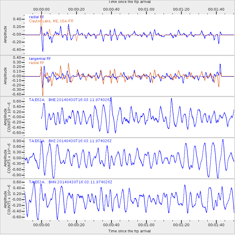
E62A Clayton Lake, ME, USA - Earthquake Result Viewer
*The percent match for this event was below the threshold and hence no stack was calculated.
| Earthquake location: |
North Of Ascension Island |
| Earthquake latitude/longitude: |
-1.2/-13.5 |
| Earthquake time(UTC): |
2014/04/30 (120) 15:52:42 GMT |
| Earthquake Depth: |
14 km |
| Earthquake Magnitude: |
5.8 MW |
| Earthquake Catalog/Contributor: |
ISC/ISC |
|
| Network: |
TA USArray Transportable Network (new EarthScope stations) |
| Station: |
E62A Clayton Lake, ME, USA |
| Lat/Lon: |
46.62 N/69.52 W |
| Elevation: |
356 m |
|
| Distance: |
68.3 deg |
| Az: |
322.046 deg |
| Baz: |
116.862 deg |
| Ray Param: |
$rayparam |
*The percent match for this event was below the threshold and hence was not used in the summary stack. |
|
| Radial Match: |
63.08642 % |
| Radial Bump: |
400 |
| Transverse Match: |
43.476078 % |
| Transverse Bump: |
400 |
| SOD ConfigId: |
3390531 |
| Insert Time: |
2019-04-11 15:48:01.417 +0000 |
| GWidth: |
2.5 |
| Max Bumps: |
400 |
| Tol: |
0.001 |
|
Signal To Noise
| Channel | StoN | STA | LTA |
| TA:E62A: :BHZ:20140430T16:03:11.974026Z | 2.4816334 | 5.788809E-7 | 2.3326608E-7 |
| TA:E62A: :BHN:20140430T16:03:11.974026Z | 1.0320777 | 2.5082727E-7 | 2.430314E-7 |
| TA:E62A: :BHE:20140430T16:03:11.974026Z | 1.5764834 | 3.1975188E-7 | 2.0282603E-7 |
| Arrivals |
| Ps | |
| PpPs | |
| PsPs/PpSs | |


