You are here: Home > Network List > TA - USArray Transportable Network (new EarthScope stations) Stations List
> Station S60A Water View, VA, USA > Earthquake Result Viewer
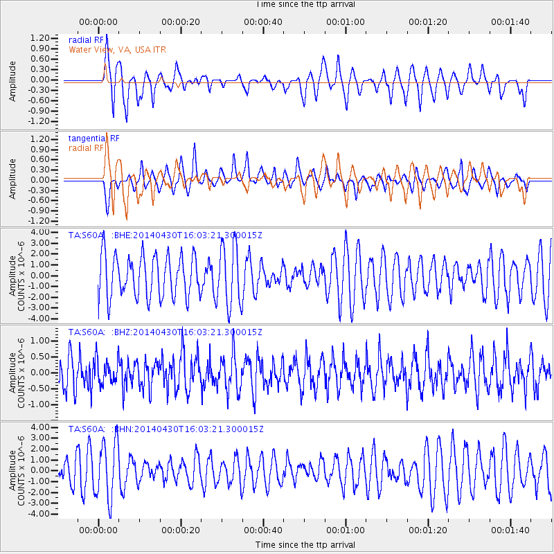
S60A Water View, VA, USA - Earthquake Result Viewer
*The percent match for this event was below the threshold and hence no stack was calculated.
| Earthquake location: |
North Of Ascension Island |
| Earthquake latitude/longitude: |
-1.2/-13.5 |
| Earthquake time(UTC): |
2014/04/30 (120) 15:52:42 GMT |
| Earthquake Depth: |
14 km |
| Earthquake Magnitude: |
5.8 MW |
| Earthquake Catalog/Contributor: |
ISC/ISC |
|
| Network: |
TA USArray Transportable Network (new EarthScope stations) |
| Station: |
S60A Water View, VA, USA |
| Lat/Lon: |
37.42 N/76.39 W |
| Elevation: |
36 m |
|
| Distance: |
69.5 deg |
| Az: |
310.852 deg |
| Baz: |
108.217 deg |
| Ray Param: |
$rayparam |
*The percent match for this event was below the threshold and hence was not used in the summary stack. |
|
| Radial Match: |
59.675095 % |
| Radial Bump: |
354 |
| Transverse Match: |
47.274437 % |
| Transverse Bump: |
325 |
| SOD ConfigId: |
3390531 |
| Insert Time: |
2019-04-11 15:48:48.301 +0000 |
| GWidth: |
2.5 |
| Max Bumps: |
400 |
| Tol: |
0.001 |
|
Signal To Noise
| Channel | StoN | STA | LTA |
| TA:S60A: :BHZ:20140430T16:03:21.300015Z | 0.8179777 | 3.898425E-7 | 4.7659307E-7 |
| TA:S60A: :BHN:20140430T16:03:21.300015Z | 2.7961626 | 2.695587E-6 | 9.640307E-7 |
| TA:S60A: :BHE:20140430T16:03:21.300015Z | 1.3362901 | 2.5969198E-6 | 1.94338E-6 |
| Arrivals |
| Ps | |
| PpPs | |
| PsPs/PpSs | |


