You are here: Home > Network List > TA - USArray Transportable Network (new EarthScope stations) Stations List
> Station L40A Anamosa, IA, USA > Earthquake Result Viewer
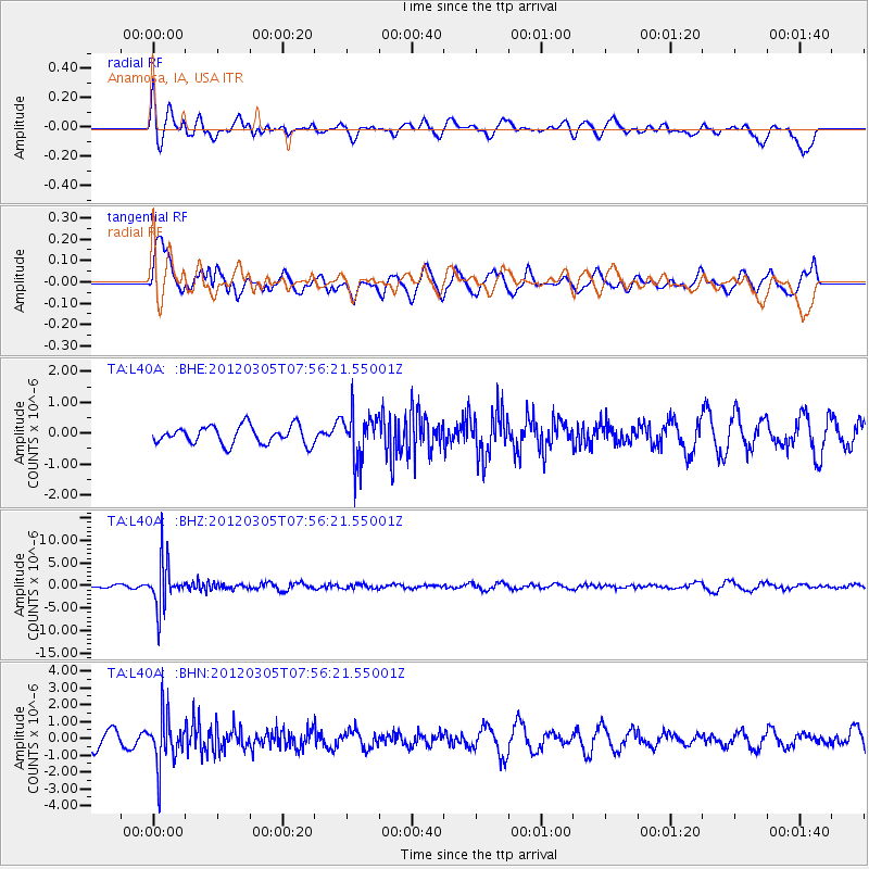
L40A Anamosa, IA, USA - Earthquake Result Viewer
*The percent match for this event was below the threshold and hence no stack was calculated.
| Earthquake location: |
Santiago Del Estero Prov., Arg. |
| Earthquake latitude/longitude: |
-28.2/-63.3 |
| Earthquake time(UTC): |
2012/03/05 (065) 07:46:10 GMT |
| Earthquake Depth: |
554 km |
| Earthquake Magnitude: |
6.0 MB, 6.1 MW, 6.1 MW |
| Earthquake Catalog/Contributor: |
WHDF/NEIC |
|
| Network: |
TA USArray Transportable Network (new EarthScope stations) |
| Station: |
L40A Anamosa, IA, USA |
| Lat/Lon: |
42.06 N/91.22 W |
| Elevation: |
242 m |
|
| Distance: |
74.6 deg |
| Az: |
338.788 deg |
| Baz: |
154.617 deg |
| Ray Param: |
$rayparam |
*The percent match for this event was below the threshold and hence was not used in the summary stack. |
|
| Radial Match: |
52.49113 % |
| Radial Bump: |
384 |
| Transverse Match: |
61.446938 % |
| Transverse Bump: |
400 |
| SOD ConfigId: |
440406 |
| Insert Time: |
2012-05-20 00:14:48.387 +0000 |
| GWidth: |
2.5 |
| Max Bumps: |
400 |
| Tol: |
0.001 |
|
Signal To Noise
| Channel | StoN | STA | LTA |
| TA:L40A: :BHZ:20120305T07:56:21.55001Z | 15.989299 | 5.107155E-6 | 3.1941084E-7 |
| TA:L40A: :BHN:20120305T07:56:21.55001Z | 2.6632988 | 1.5087059E-6 | 5.6648014E-7 |
| TA:L40A: :BHE:20120305T07:56:21.55001Z | 2.6320763 | 7.7425483E-7 | 2.9416123E-7 |
| Arrivals |
| Ps | |
| PpPs | |
| PsPs/PpSs | |


