You are here: Home > Network List > TA - USArray Transportable Network (new EarthScope stations) Stations List
> Station X49A Woodville, AR, USA > Earthquake Result Viewer
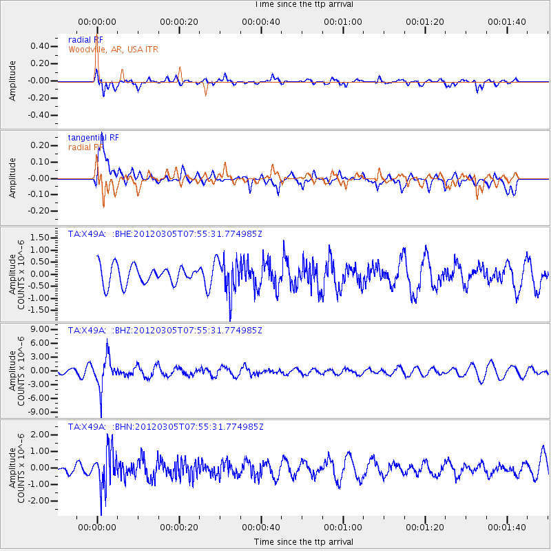
X49A Woodville, AR, USA - Earthquake Result Viewer
*The percent match for this event was below the threshold and hence no stack was calculated.
| Earthquake location: |
Santiago Del Estero Prov., Arg. |
| Earthquake latitude/longitude: |
-28.2/-63.3 |
| Earthquake time(UTC): |
2012/03/05 (065) 07:46:10 GMT |
| Earthquake Depth: |
554 km |
| Earthquake Magnitude: |
6.0 MB, 6.1 MW, 6.1 MW |
| Earthquake Catalog/Contributor: |
WHDF/NEIC |
|
| Network: |
TA USArray Transportable Network (new EarthScope stations) |
| Station: |
X49A Woodville, AR, USA |
| Lat/Lon: |
34.51 N/86.33 W |
| Elevation: |
182 m |
|
| Distance: |
66.1 deg |
| Az: |
339.308 deg |
| Baz: |
157.821 deg |
| Ray Param: |
$rayparam |
*The percent match for this event was below the threshold and hence was not used in the summary stack. |
|
| Radial Match: |
49.796154 % |
| Radial Bump: |
400 |
| Transverse Match: |
69.07472 % |
| Transverse Bump: |
400 |
| SOD ConfigId: |
440406 |
| Insert Time: |
2012-05-20 00:22:27.261 +0000 |
| GWidth: |
2.5 |
| Max Bumps: |
400 |
| Tol: |
0.001 |
|
Signal To Noise
| Channel | StoN | STA | LTA |
| TA:X49A: :BHZ:20120305T07:55:31.774985Z | 5.301167 | 3.3149056E-6 | 6.253162E-7 |
| TA:X49A: :BHN:20120305T07:55:31.774985Z | 4.5066733 | 1.1446538E-6 | 2.5399083E-7 |
| TA:X49A: :BHE:20120305T07:55:31.774985Z | 1.9285872 | 7.2906255E-7 | 3.7802934E-7 |
| Arrivals |
| Ps | |
| PpPs | |
| PsPs/PpSs | |


