You are here: Home > Network List > TA - USArray Transportable Network (new EarthScope stations) Stations List
> Station 151A Opelika, AL, USA > Earthquake Result Viewer
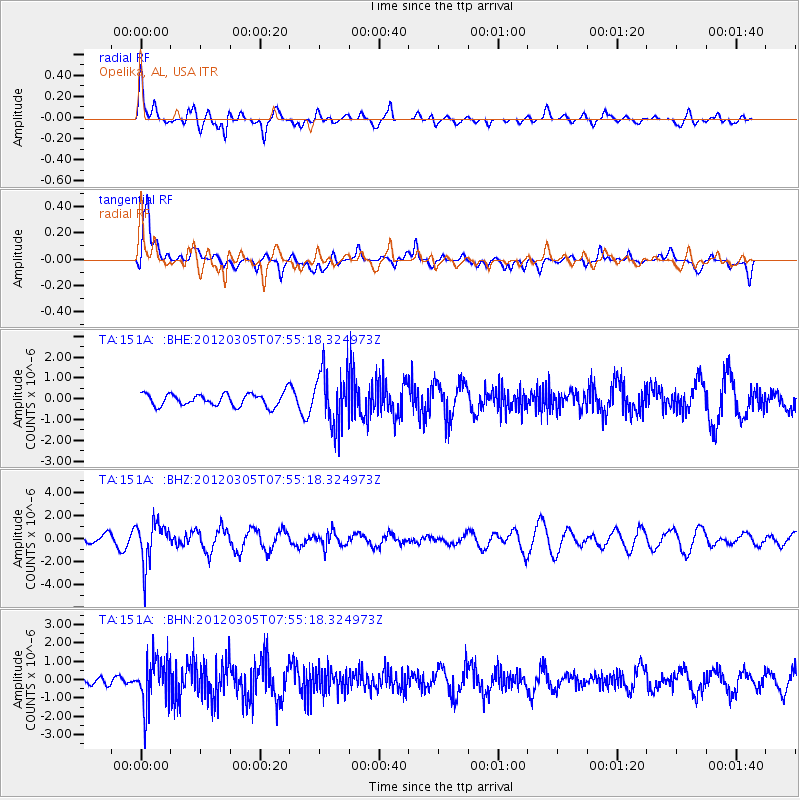
151A Opelika, AL, USA - Earthquake Result Viewer
*The percent match for this event was below the threshold and hence no stack was calculated.
| Earthquake location: |
Santiago Del Estero Prov., Arg. |
| Earthquake latitude/longitude: |
-28.2/-63.3 |
| Earthquake time(UTC): |
2012/03/05 (065) 07:46:10 GMT |
| Earthquake Depth: |
554 km |
| Earthquake Magnitude: |
6.0 MB, 6.1 MW, 6.1 MW |
| Earthquake Catalog/Contributor: |
WHDF/NEIC |
|
| Network: |
TA USArray Transportable Network (new EarthScope stations) |
| Station: |
151A Opelika, AL, USA |
| Lat/Lon: |
32.53 N/85.33 W |
| Elevation: |
211 m |
|
| Distance: |
64.0 deg |
| Az: |
339.348 deg |
| Baz: |
158.387 deg |
| Ray Param: |
$rayparam |
*The percent match for this event was below the threshold and hence was not used in the summary stack. |
|
| Radial Match: |
57.199482 % |
| Radial Bump: |
384 |
| Transverse Match: |
71.437004 % |
| Transverse Bump: |
400 |
| SOD ConfigId: |
440406 |
| Insert Time: |
2012-05-20 00:23:55.727 +0000 |
| GWidth: |
2.5 |
| Max Bumps: |
400 |
| Tol: |
0.001 |
|
Signal To Noise
| Channel | StoN | STA | LTA |
| TA:151A: :BHZ:20120305T07:55:18.324973Z | 3.2902095 | 1.7732015E-6 | 5.389327E-7 |
| TA:151A: :BHN:20120305T07:55:18.324973Z | 3.2516565 | 1.2890936E-6 | 3.9644212E-7 |
| TA:151A: :BHE:20120305T07:55:18.324973Z | 4.3485045 | 1.317819E-6 | 3.0305108E-7 |
| Arrivals |
| Ps | |
| PpPs | |
| PsPs/PpSs | |


