You are here: Home > Network List > TA - USArray Transportable Network (new EarthScope stations) Stations List
> Station J04D Umpqua National Forest, Toketee, OR, USA > Earthquake Result Viewer
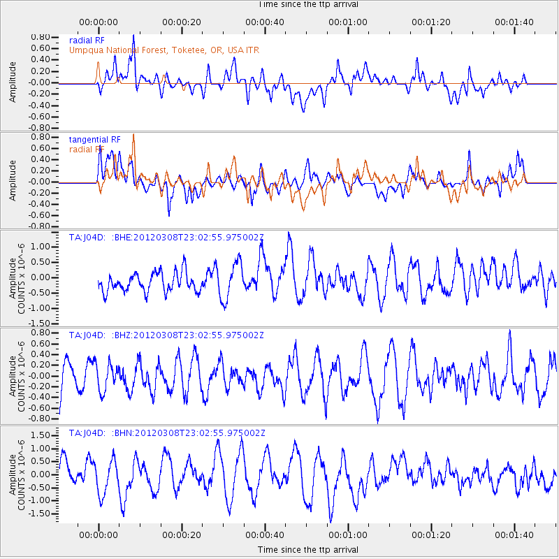
J04D Umpqua National Forest, Toketee, OR, USA - Earthquake Result Viewer
*The percent match for this event was below the threshold and hence no stack was calculated.
| Earthquake location: |
Southern Xinjiang, China |
| Earthquake latitude/longitude: |
39.4/81.3 |
| Earthquake time(UTC): |
2012/03/08 (068) 22:50:08 GMT |
| Earthquake Depth: |
38 km |
| Earthquake Magnitude: |
5.8 MB, 5.6 MS, 5.9 MW, 5.8 MW |
| Earthquake Catalog/Contributor: |
WHDF/NEIC |
|
| Network: |
TA USArray Transportable Network (new EarthScope stations) |
| Station: |
J04D Umpqua National Forest, Toketee, OR, USA |
| Lat/Lon: |
43.24 N/122.11 W |
| Elevation: |
1948 m |
|
| Distance: |
95.1 deg |
| Az: |
16.951 deg |
| Baz: |
341.989 deg |
| Ray Param: |
$rayparam |
*The percent match for this event was below the threshold and hence was not used in the summary stack. |
|
| Radial Match: |
50.399025 % |
| Radial Bump: |
400 |
| Transverse Match: |
52.850803 % |
| Transverse Bump: |
400 |
| SOD ConfigId: |
440406 |
| Insert Time: |
2012-05-20 00:43:15.842 +0000 |
| GWidth: |
2.5 |
| Max Bumps: |
400 |
| Tol: |
0.001 |
|
Signal To Noise
| Channel | StoN | STA | LTA |
| TA:J04D: :BHZ:20120308T23:02:55.975002Z | 0.9224126 | 2.516444E-7 | 2.728111E-7 |
| TA:J04D: :BHN:20120308T23:02:55.975002Z | 1.0150673 | 6.394955E-7 | 6.3000306E-7 |
| TA:J04D: :BHE:20120308T23:02:55.975002Z | 2.0020723 | 6.126499E-7 | 3.0600788E-7 |
| Arrivals |
| Ps | |
| PpPs | |
| PsPs/PpSs | |


