You are here: Home > Network List > TA - USArray Transportable Network (new EarthScope stations) Stations List
> Station E31A Nome, ND, USA > Earthquake Result Viewer
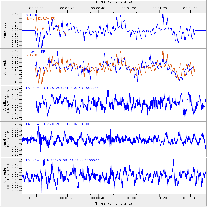
E31A Nome, ND, USA - Earthquake Result Viewer
*The percent match for this event was below the threshold and hence no stack was calculated.
| Earthquake location: |
Southern Xinjiang, China |
| Earthquake latitude/longitude: |
39.4/81.3 |
| Earthquake time(UTC): |
2012/03/08 (068) 22:50:08 GMT |
| Earthquake Depth: |
38 km |
| Earthquake Magnitude: |
5.8 MB, 5.6 MS, 5.9 MW, 5.8 MW |
| Earthquake Catalog/Contributor: |
WHDF/NEIC |
|
| Network: |
TA USArray Transportable Network (new EarthScope stations) |
| Station: |
E31A Nome, ND, USA |
| Lat/Lon: |
46.56 N/97.89 W |
| Elevation: |
427 m |
|
| Distance: |
94.4 deg |
| Az: |
359.443 deg |
| Baz: |
0.626 deg |
| Ray Param: |
$rayparam |
*The percent match for this event was below the threshold and hence was not used in the summary stack. |
|
| Radial Match: |
39.151047 % |
| Radial Bump: |
400 |
| Transverse Match: |
45.15209 % |
| Transverse Bump: |
400 |
| SOD ConfigId: |
440406 |
| Insert Time: |
2012-05-20 00:44:02.082 +0000 |
| GWidth: |
2.5 |
| Max Bumps: |
400 |
| Tol: |
0.001 |
|
Signal To Noise
| Channel | StoN | STA | LTA |
| TA:E31A: :BHZ:20120308T23:02:53.100002Z | 2.8720145 | 4.4256777E-7 | 1.5409664E-7 |
| TA:E31A: :BHN:20120308T23:02:53.100002Z | 1.2973284 | 3.351545E-7 | 2.5834208E-7 |
| TA:E31A: :BHE:20120308T23:02:53.100002Z | 0.73575103 | 1.9192962E-7 | 2.6086218E-7 |
| Arrivals |
| Ps | |
| PpPs | |
| PsPs/PpSs | |


