INU Inuyama, Japan - Earthquake Result Viewer
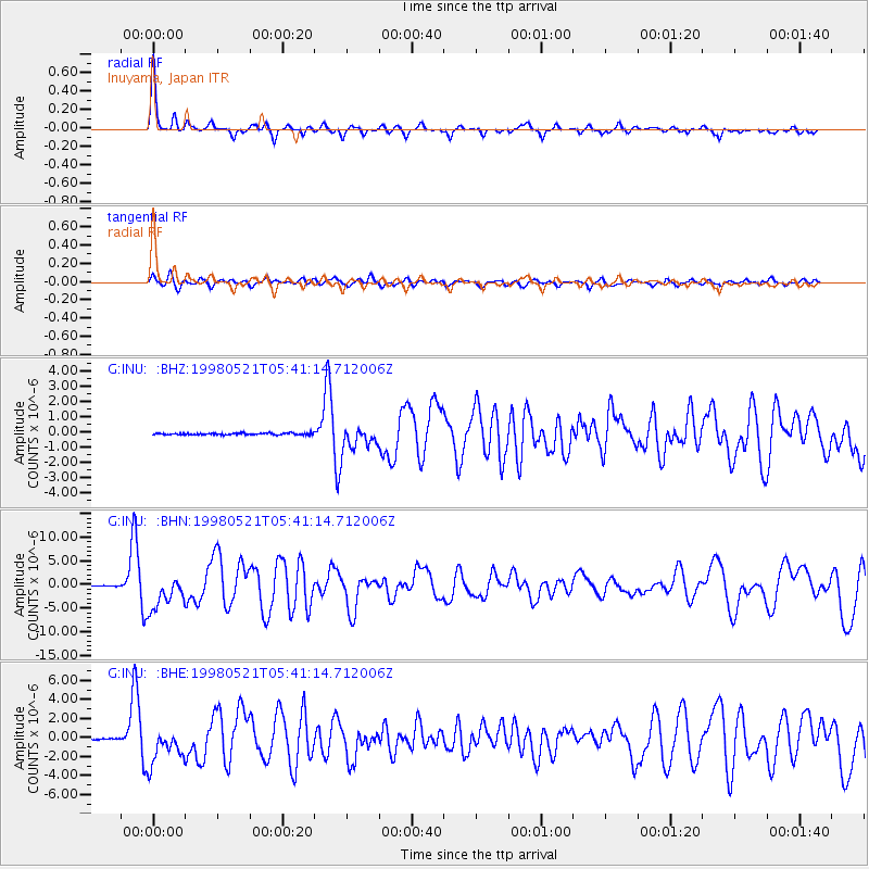
Earthquake location: Minahassa Peninsula, Sulawesi
Earthquake latitude/longitude: 0.2/119.6
Earthquake time(UTC): 1998/05/21 (141) 05:34:25 GMT
Earthquake Depth: 33 km
Earthquake Magnitude: 6.2 MB, 6.3 MS, 6.6 UNKNOWN, 6.6 MW
Earthquake Catalog/Contributor: WHDF/NEIC
Network: G GEOSCOPE
Station: INU Inuyama, Japan
Lat/Lon: 35.35 N/137.03 E
Elevation: 132 m
Distance: 38.6 deg
Az: 23.149 deg
Baz: 208.745 deg
Ray Param: 0.07542594
Estimated Moho Depth: 21.0 km
Estimated Crust Vp/Vs: 1.99
Assumed Crust Vp: 6.461 km/s
Estimated Crust Vs: 3.247 km/s
Estimated Crust Poisson's Ratio: 0.33
Radial Match: 91.902824 %
Radial Bump: 291
Transverse Match: 77.09032 %
Transverse Bump: 400
SOD ConfigId: 4480
Insert Time: 2010-02-26 23:17:47.055 +0000
GWidth: 2.5
Max Bumps: 400
Tol: 0.001

Signal To Noise

ChannelStoNSTALTA
G:INU: :BHN:19980521T05:41:14.712006Z47.952983.5390408E-67.380231E-8
G:INU: :BHE:19980521T05:41:14.712006Z32.3076931.8512965E-65.730203E-8
G:INU: :BHZ:19980521T05:41:14.712006Z14.3772358.0330943E-75.587371E-8
Arrivals
Ps3.4 SECOND
PpPs9.1 SECOND
PsPs/PpSs13 SECOND