BFS Mt Baldy Forest Station - Earthquake Result Viewer
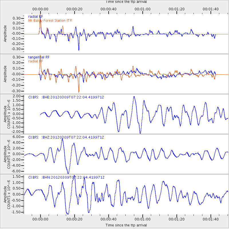
Earthquake location: Vanuatu Islands
Earthquake latitude/longitude: -19.1/169.6
Earthquake time(UTC): 2012/03/09 (069) 07:09:50 GMT
Earthquake Depth: 16 km
Earthquake Magnitude: 6.1 MB, 6.7 MS, 6.7 MW, 6.7 MW
Earthquake Catalog/Contributor: WHDF/NEIC
Network: CI Caltech Regional Seismic Network
Station: BFS Mt Baldy Forest Station
Lat/Lon: 34.24 N/117.66 W
Elevation: 1312 m
Distance: 87.1 deg
Az: 52.381 deg
Baz: 244.687 deg
Ray Param: 0.043539558
Estimated Moho Depth: 44.25 km
Estimated Crust Vp/Vs: 1.63
Assumed Crust Vp: 6.276 km/s
Estimated Crust Vs: 3.85 km/s
Estimated Crust Poisson's Ratio: 0.20
Radial Match: 89.7435 %
Radial Bump: 400
Transverse Match: 60.275543 %
Transverse Bump: 400
SOD ConfigId: 440406
Insert Time: 2012-05-20 00:57:56.643 +0000
GWidth: 2.5
Max Bumps: 400
Tol: 0.001

Signal To Noise

ChannelStoNSTALTA
CI:BFS: :BHZ:20120309T07:22:04.419971Z6.14005231.0309701E-61.6790901E-7
CI:BFS: :BHN:20120309T07:22:04.419971Z1.07304974.1273057E-73.8463324E-7
CI:BFS: :BHE:20120309T07:22:04.419971Z1.12098222.816624E-72.5126397E-7
Arrivals
Ps4.5 SECOND
PpPs18 SECOND
PsPs/PpSs23 SECOND