INU Inuyama, Japan - Earthquake Result Viewer
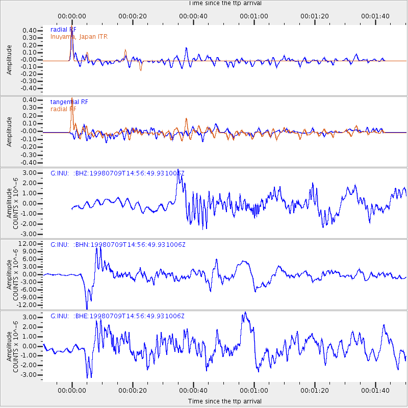
Earthquake location: Kermadec Islands, New Zealand
Earthquake latitude/longitude: -30.5/-179.0
Earthquake time(UTC): 1998/07/09 (190) 14:45:39 GMT
Earthquake Depth: 130 km
Earthquake Magnitude: 6.2 MB, 6.2 MS, 6.9 UNKNOWN, 6.4 ME
Earthquake Catalog/Contributor: WHDF/NEIC
Network: G GEOSCOPE
Station: INU Inuyama, Japan
Lat/Lon: 35.35 N/137.03 E
Elevation: 132 m
Distance: 77.5 deg
Az: 324.445 deg
Baz: 142.118 deg
Ray Param: 0.049990673
Estimated Moho Depth: 38.75 km
Estimated Crust Vp/Vs: 1.62
Assumed Crust Vp: 6.461 km/s
Estimated Crust Vs: 3.989 km/s
Estimated Crust Poisson's Ratio: 0.19
Radial Match: 92.35525 %
Radial Bump: 400
Transverse Match: 79.47423 %
Transverse Bump: 400
SOD ConfigId: 4480
Insert Time: 2010-02-26 23:17:55.726 +0000
GWidth: 2.5
Max Bumps: 400
Tol: 0.001

Signal To Noise

ChannelStoNSTALTA
G:INU: :BHN:19980709T14:56:49.931006Z15.5176933.396476E-62.1887763E-7
G:INU: :BHE:19980709T14:56:49.931006Z1.62073786.508062E-74.0154933E-7
G:INU: :BHZ:19980709T14:56:49.931006Z2.25683837.872901E-73.4884647E-7
Arrivals
Ps3.8 SECOND
PpPs15 SECOND
PsPs/PpSs19 SECOND