You are here: Home > Network List > AV - Alaska Volcano Observatory Stations List
> Station SPCR Ckakachatna River, Mount Spurr, Alaska > Earthquake Result Viewer
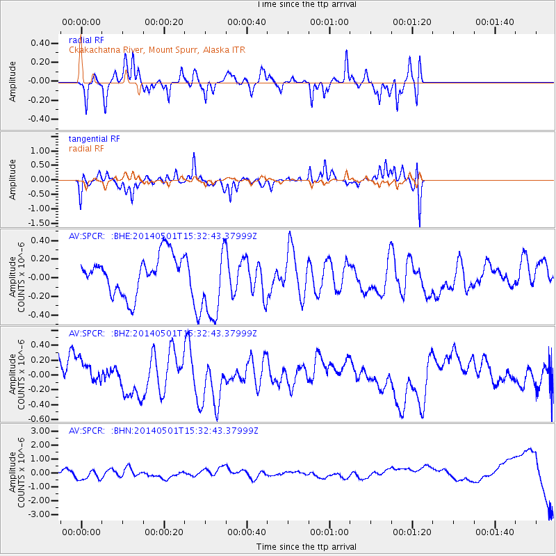
SPCR Ckakachatna River, Mount Spurr, Alaska - Earthquake Result Viewer
*The percent match for this event was below the threshold and hence no stack was calculated.
| Earthquake location: |
East Of Philippine Islands |
| Earthquake latitude/longitude: |
6.5/130.2 |
| Earthquake time(UTC): |
2014/05/01 (121) 15:21:13 GMT |
| Earthquake Depth: |
6.8 km |
| Earthquake Magnitude: |
5.2 MW |
| Earthquake Catalog/Contributor: |
ISC/ISC |
|
| Network: |
AV Alaska Volcano Observatory |
| Station: |
SPCR Ckakachatna River, Mount Spurr, Alaska |
| Lat/Lon: |
61.20 N/152.21 W |
| Elevation: |
984 m |
|
| Distance: |
78.3 deg |
| Az: |
28.876 deg |
| Baz: |
262.257 deg |
| Ray Param: |
$rayparam |
*The percent match for this event was below the threshold and hence was not used in the summary stack. |
|
| Radial Match: |
61.557056 % |
| Radial Bump: |
313 |
| Transverse Match: |
51.12478 % |
| Transverse Bump: |
341 |
| SOD ConfigId: |
3390531 |
| Insert Time: |
2019-04-11 16:01:17.227 +0000 |
| GWidth: |
2.5 |
| Max Bumps: |
400 |
| Tol: |
0.001 |
|
Signal To Noise
| Channel | StoN | STA | LTA |
| AV:SPCR: :BHZ:20140501T15:32:43.37999Z | 1.0365376 | 1.7023392E-7 | 1.6423321E-7 |
| AV:SPCR: :BHN:20140501T15:32:43.37999Z | 1.6662906 | 3.5192315E-7 | 2.1120154E-7 |
| AV:SPCR: :BHE:20140501T15:32:43.37999Z | 1.9262038 | 3.861576E-7 | 2.0047598E-7 |
| Arrivals |
| Ps | |
| PpPs | |
| PsPs/PpSs | |


