You are here: Home > Network List > TA - USArray Transportable Network (new EarthScope stations) Stations List
> Station K35A Storm Lake, IA, USA > Earthquake Result Viewer
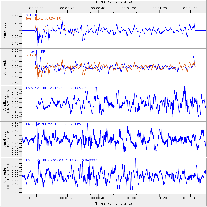
K35A Storm Lake, IA, USA - Earthquake Result Viewer
*The percent match for this event was below the threshold and hence no stack was calculated.
| Earthquake location: |
Kuril Islands |
| Earthquake latitude/longitude: |
45.2/147.6 |
| Earthquake time(UTC): |
2012/03/12 (072) 12:32:46 GMT |
| Earthquake Depth: |
110 km |
| Earthquake Magnitude: |
5.7 MB, 5.5 MW, 5.6 MW |
| Earthquake Catalog/Contributor: |
WHDF/NEIC |
|
| Network: |
TA USArray Transportable Network (new EarthScope stations) |
| Station: |
K35A Storm Lake, IA, USA |
| Lat/Lon: |
42.72 N/95.23 W |
| Elevation: |
439 m |
|
| Distance: |
76.1 deg |
| Az: |
42.496 deg |
| Baz: |
319.633 deg |
| Ray Param: |
$rayparam |
*The percent match for this event was below the threshold and hence was not used in the summary stack. |
|
| Radial Match: |
41.691883 % |
| Radial Bump: |
400 |
| Transverse Match: |
52.2586 % |
| Transverse Bump: |
400 |
| SOD ConfigId: |
440406 |
| Insert Time: |
2012-05-25 21:58:32.273 +0000 |
| GWidth: |
2.5 |
| Max Bumps: |
400 |
| Tol: |
0.001 |
|
Signal To Noise
| Channel | StoN | STA | LTA |
| TA:K35A: :BHZ:20120312T12:43:50.84999Z | 2.4788368 | 3.5073595E-7 | 1.4149214E-7 |
| TA:K35A: :BHN:20120312T12:43:50.84999Z | 2.2180946 | 3.6949427E-7 | 1.6658183E-7 |
| TA:K35A: :BHE:20120312T12:43:50.84999Z | 1.815741 | 2.8320994E-7 | 1.5597486E-7 |
| Arrivals |
| Ps | |
| PpPs | |
| PsPs/PpSs | |


