You are here: Home > Network List > TA - USArray Transportable Network (new EarthScope stations) Stations List
> Station F36A Milaca, MN, USA > Earthquake Result Viewer
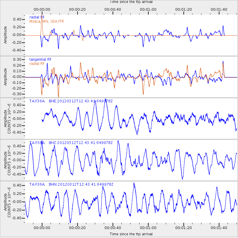
F36A Milaca, MN, USA - Earthquake Result Viewer
*The percent match for this event was below the threshold and hence no stack was calculated.
| Earthquake location: |
Kuril Islands |
| Earthquake latitude/longitude: |
45.2/147.6 |
| Earthquake time(UTC): |
2012/03/12 (072) 12:32:46 GMT |
| Earthquake Depth: |
110 km |
| Earthquake Magnitude: |
5.7 MB, 5.5 MW, 5.6 MW |
| Earthquake Catalog/Contributor: |
WHDF/NEIC |
|
| Network: |
TA USArray Transportable Network (new EarthScope stations) |
| Station: |
F36A Milaca, MN, USA |
| Lat/Lon: |
45.86 N/93.52 W |
| Elevation: |
345 m |
|
| Distance: |
74.5 deg |
| Az: |
39.433 deg |
| Baz: |
320.043 deg |
| Ray Param: |
$rayparam |
*The percent match for this event was below the threshold and hence was not used in the summary stack. |
|
| Radial Match: |
42.749157 % |
| Radial Bump: |
400 |
| Transverse Match: |
44.17583 % |
| Transverse Bump: |
400 |
| SOD ConfigId: |
440406 |
| Insert Time: |
2012-05-25 21:59:57.880 +0000 |
| GWidth: |
2.5 |
| Max Bumps: |
400 |
| Tol: |
0.001 |
|
Signal To Noise
| Channel | StoN | STA | LTA |
| TA:F36A: :BHZ:20120312T12:43:41.649978Z | 1.7090571 | 2.972201E-7 | 1.7390882E-7 |
| TA:F36A: :BHN:20120312T12:43:41.649978Z | 1.163115 | 1.9026518E-7 | 1.6358244E-7 |
| TA:F36A: :BHE:20120312T12:43:41.649978Z | 1.8415704 | 2.827955E-7 | 1.5356215E-7 |
| Arrivals |
| Ps | |
| PpPs | |
| PsPs/PpSs | |


