You are here: Home > Network List > US - United States National Seismic Network Stations List
> Station MNTX Cornudas Mountains, Texas, USA > Earthquake Result Viewer
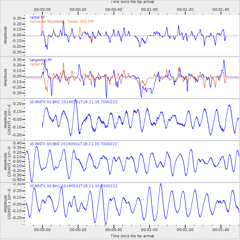
MNTX Cornudas Mountains, Texas, USA - Earthquake Result Viewer
*The percent match for this event was below the threshold and hence no stack was calculated.
| Earthquake location: |
Kermadec Islands Region |
| Earthquake latitude/longitude: |
-29.0/-176.4 |
| Earthquake time(UTC): |
2014/05/01 (121) 18:09:09 GMT |
| Earthquake Depth: |
36 km |
| Earthquake Magnitude: |
5.2 MW |
| Earthquake Catalog/Contributor: |
ISC/ISC |
|
| Network: |
US United States National Seismic Network |
| Station: |
MNTX Cornudas Mountains, Texas, USA |
| Lat/Lon: |
31.70 N/105.38 W |
| Elevation: |
404 m |
|
| Distance: |
90.5 deg |
| Az: |
53.721 deg |
| Baz: |
235.961 deg |
| Ray Param: |
$rayparam |
*The percent match for this event was below the threshold and hence was not used in the summary stack. |
|
| Radial Match: |
66.24957 % |
| Radial Bump: |
400 |
| Transverse Match: |
53.266453 % |
| Transverse Bump: |
400 |
| SOD ConfigId: |
3390531 |
| Insert Time: |
2019-04-11 16:08:10.345 +0000 |
| GWidth: |
2.5 |
| Max Bumps: |
400 |
| Tol: |
0.001 |
|
Signal To Noise
| Channel | StoN | STA | LTA |
| US:MNTX:00:BHZ:20140501T18:21:36.700022Z | 1.1165504 | 1.5708297E-7 | 1.4068594E-7 |
| US:MNTX:00:BH1:20140501T18:21:36.700022Z | 1.7122624 | 1.2566677E-7 | 7.339224E-8 |
| US:MNTX:00:BH2:20140501T18:21:36.700022Z | 0.74317175 | 7.4867415E-8 | 1.007404E-7 |
| Arrivals |
| Ps | |
| PpPs | |
| PsPs/PpSs | |


