INU Inuyama, Japan - Earthquake Result Viewer
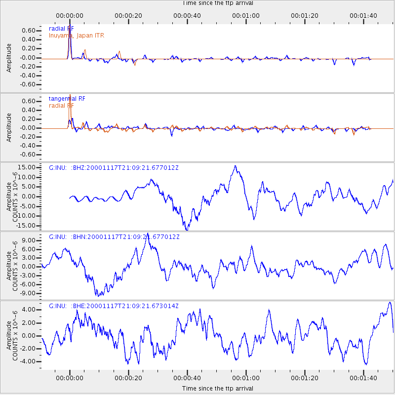
Earthquake location: New Britain Region, P.N.G.
Earthquake latitude/longitude: -5.5/151.8
Earthquake time(UTC): 2000/11/17 (322) 21:01:56 GMT
Earthquake Depth: 33 km
Earthquake Magnitude: 6.2 MB, 8.0 MS, 7.6 MW, 6.9 ME
Earthquake Catalog/Contributor: WHDF/NEIC
Network: G GEOSCOPE
Station: INU Inuyama, Japan
Lat/Lon: 35.35 N/137.03 E
Elevation: 132 m
Distance: 42.9 deg
Az: 342.207 deg
Baz: 158.153 deg
Ray Param: 0.07280719
Estimated Moho Depth: 38.5 km
Estimated Crust Vp/Vs: 1.71
Assumed Crust Vp: 6.461 km/s
Estimated Crust Vs: 3.79 km/s
Estimated Crust Poisson's Ratio: 0.24
Radial Match: 92.91539 %
Radial Bump: 244
Transverse Match: 81.70722 %
Transverse Bump: 395
SOD ConfigId: 20082
Insert Time: 2010-02-26 23:18:54.870 +0000
GWidth: 2.5
Max Bumps: 400
Tol: 0.001

Signal To Noise

ChannelStoNSTALTA
G:INU: :BHN:20001117T21:09:21.677012Z2.2713083.1242596E-61.3755332E-6
G:INU: :BHE:20001117T21:09:21.673014Z2.2960572.5859167E-61.1262424E-6
G:INU: :BHZ:20001117T21:09:21.677012Z1.62024343.2868986E-62.028645E-6
Arrivals
Ps4.5 SECOND
PpPs15 SECOND
PsPs/PpSs20 SECOND