BFS Mt Baldy Forest Station - Earthquake Result Viewer
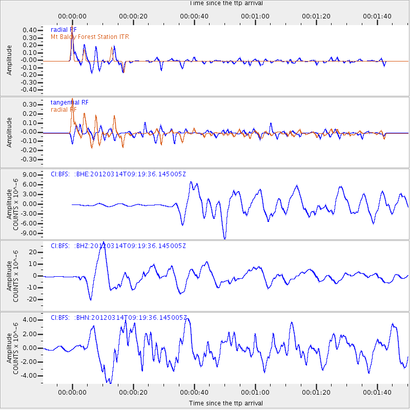
Earthquake location: Off East Coast Of Honshu, Japan
Earthquake latitude/longitude: 40.9/144.9
Earthquake time(UTC): 2012/03/14 (074) 09:08:35 GMT
Earthquake Depth: 12 km
Earthquake Magnitude: 6.7 MB, 6.9 MS, 6.9 MW, 7.0 MW
Earthquake Catalog/Contributor: WHDF/NEIC
Network: CI Caltech Regional Seismic Network
Station: BFS Mt Baldy Forest Station
Lat/Lon: 34.24 N/117.66 W
Elevation: 1312 m
Distance: 73.5 deg
Az: 58.973 deg
Baz: 308.351 deg
Ray Param: 0.052970964
Estimated Moho Depth: 32.0 km
Estimated Crust Vp/Vs: 1.83
Assumed Crust Vp: 6.276 km/s
Estimated Crust Vs: 3.425 km/s
Estimated Crust Poisson's Ratio: 0.29
Radial Match: 92.45426 %
Radial Bump: 400
Transverse Match: 88.33617 %
Transverse Bump: 400
SOD ConfigId: 440406
Insert Time: 2012-05-25 22:27:18.622 +0000
GWidth: 2.5
Max Bumps: 400
Tol: 0.001

Signal To Noise

ChannelStoNSTALTA
CI:BFS: :BHZ:20120314T09:19:36.145005Z5.88038061.4781538E-62.5137044E-7
CI:BFS: :BHN:20120314T09:19:36.145005Z1.9434733.2577137E-71.6762331E-7
CI:BFS: :BHE:20120314T09:19:36.145005Z1.60432464.0988547E-72.554879E-7
Arrivals
Ps4.4 SECOND
PpPs14 SECOND
PsPs/PpSs18 SECOND