
CLF Chambon la Foret observatory, France - Earthquake Result Viewer
| ||||||||||||||||||
| ||||||||||||||||||
| ||||||||||||||||||
|
Signal To Noise
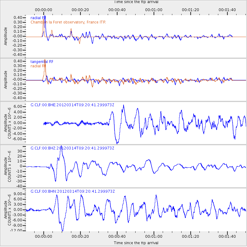
| Channel | StoN | STA | LTA |
| G:CLF:00:BHZ:20120314T09:20:41.299973Z | 5.5843744 | 1.8191878E-6 | 3.2576392E-7 |
| G:CLF:00:BHN:20120314T09:20:41.299973Z | 1.1514784 | 6.5340805E-7 | 5.674514E-7 |
| G:CLF:00:BHE:20120314T09:20:41.299973Z | 0.75787944 | 2.676415E-7 | 3.5314523E-7 |
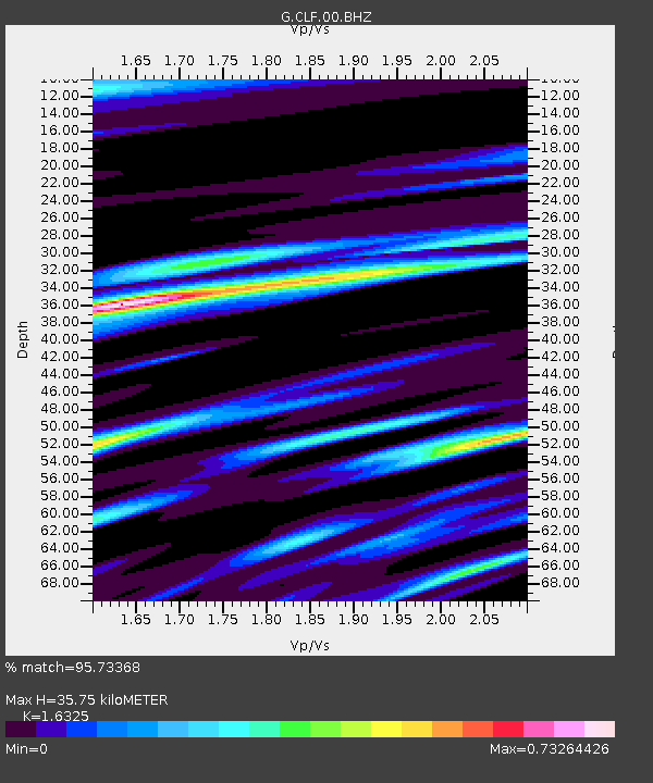
| Arrivals | |
| Ps | 3.8 SECOND |
| PpPs | 15 SECOND |
| PsPs/PpSs | 19 SECOND |

