GRFO Grafenberg, Germany - Earthquake Result Viewer
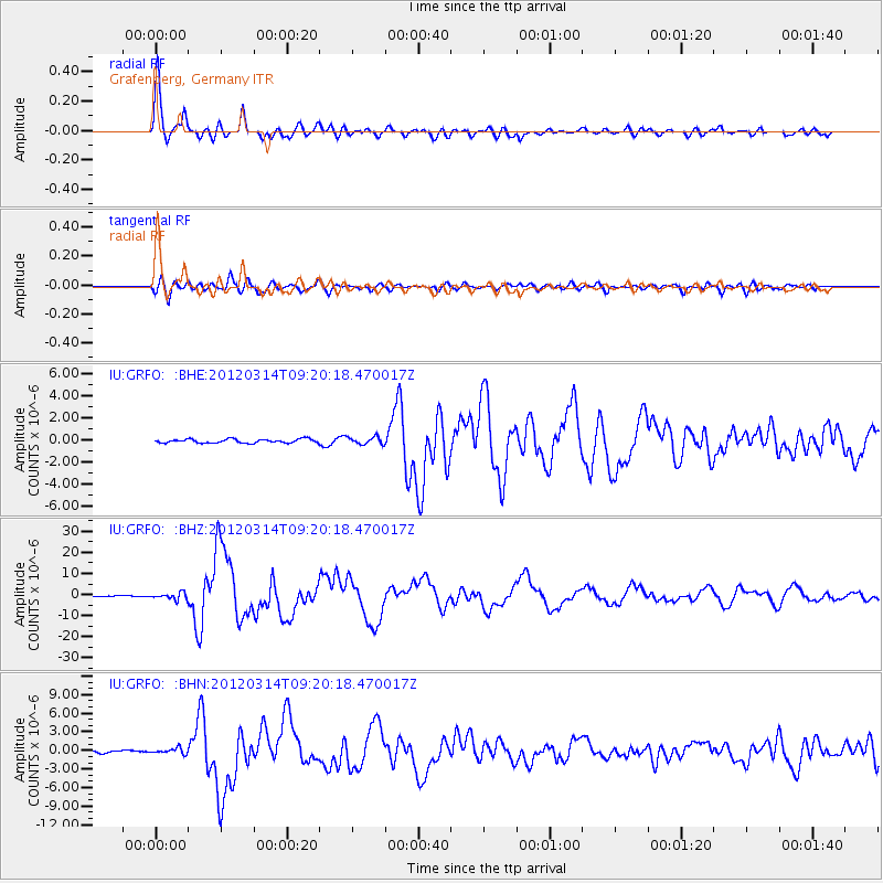
Earthquake location: Off East Coast Of Honshu, Japan
Earthquake latitude/longitude: 40.9/144.9
Earthquake time(UTC): 2012/03/14 (074) 09:08:35 GMT
Earthquake Depth: 12 km
Earthquake Magnitude: 6.7 MB, 6.9 MS, 6.9 MW, 7.0 MW
Earthquake Catalog/Contributor: WHDF/NEIC
Network: IU Global Seismograph Network (GSN - IRIS/USGS)
Station: GRFO Grafenberg, Germany
Lat/Lon: 49.69 N/11.22 E
Elevation: 384 m
Distance: 81.1 deg
Az: 331.633 deg
Baz: 33.688 deg
Ray Param: 0.04785292
Estimated Moho Depth: 28.75 km
Estimated Crust Vp/Vs: 1.93
Assumed Crust Vp: 6.182 km/s
Estimated Crust Vs: 3.207 km/s
Estimated Crust Poisson's Ratio: 0.32
Radial Match: 97.26164 %
Radial Bump: 400
Transverse Match: 89.70464 %
Transverse Bump: 400
SOD ConfigId: 440406
Insert Time: 2012-05-25 22:33:26.714 +0000
GWidth: 2.5
Max Bumps: 400
Tol: 0.001

Signal To Noise

ChannelStoNSTALTA
IU:GRFO: :BHZ:20120314T09:20:18.470017Z9.2445651.6126997E-61.7444842E-7
IU:GRFO: :BHN:20120314T09:20:18.470017Z2.06193644.5371075E-72.200411E-7
IU:GRFO: :BHE:20120314T09:20:18.470017Z1.9097763.3044228E-71.7302672E-7
Arrivals
Ps4.4 SECOND
PpPs13 SECOND
PsPs/PpSs18 SECOND