
UTMT Martin, TN - Earthquake Result Viewer
| ||||||||||||||||||
| ||||||||||||||||||
| ||||||||||||||||||
|
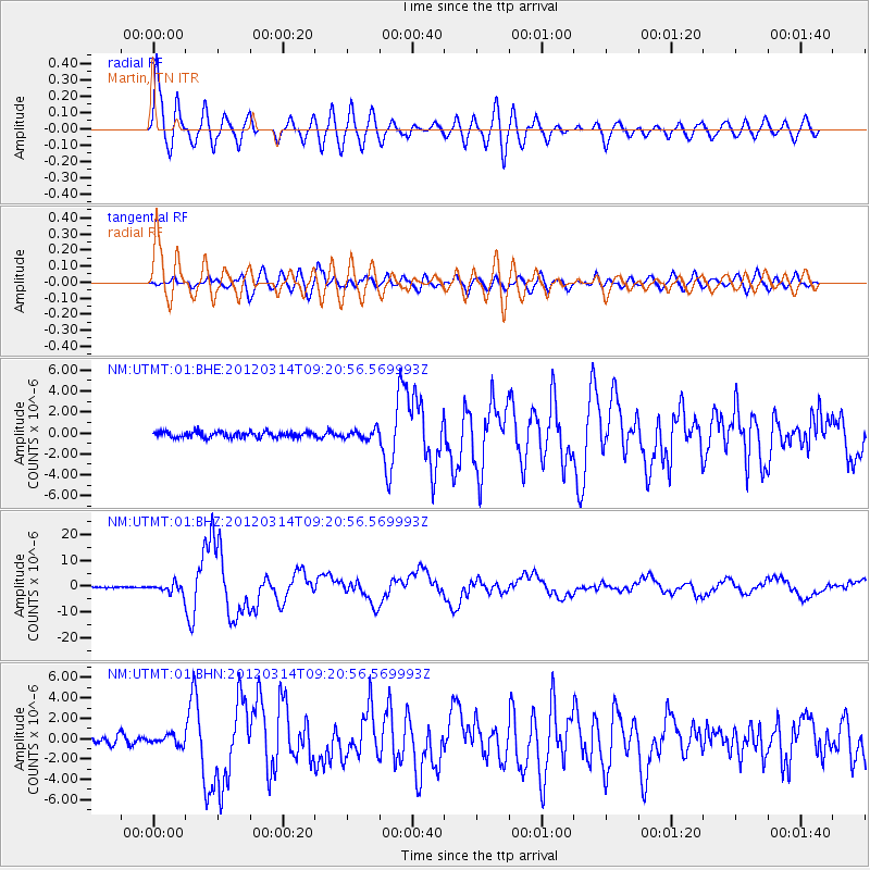
Signal To Noise
| Channel | StoN | STA | LTA |
| NM:UTMT:01:BHZ:20120314T09:20:56.569993Z | 10.226536 | 1.8901444E-6 | 1.8482743E-7 |
| NM:UTMT:01:BHN:20120314T09:20:56.569993Z | 1.5461156 | 4.739535E-7 | 3.0654468E-7 |
| NM:UTMT:01:BHE:20120314T09:20:56.569993Z | 1.5329541 | 4.3044693E-7 | 2.807957E-7 |
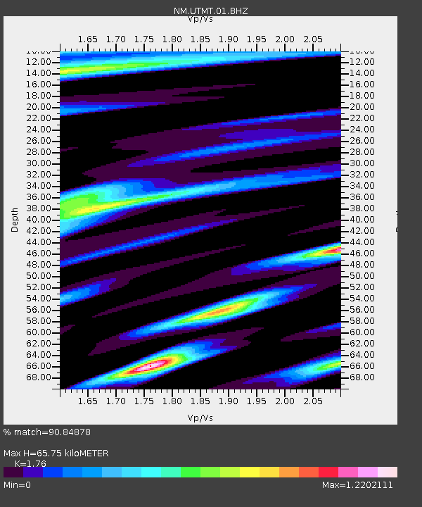
| Arrivals | |
| Ps | 7.9 SECOND |
| PpPs | 28 SECOND |
| PsPs/PpSs | 35 SECOND |

