Q24A Divide, CO, USA - Earthquake Result Viewer
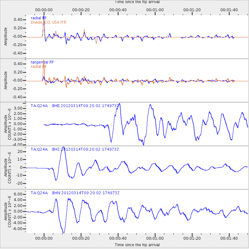
Earthquake location: Off East Coast Of Honshu, Japan
Earthquake latitude/longitude: 40.9/144.9
Earthquake time(UTC): 2012/03/14 (074) 09:08:35 GMT
Earthquake Depth: 12 km
Earthquake Magnitude: 6.7 MB, 6.9 MS, 6.9 MW, 7.0 MW
Earthquake Catalog/Contributor: WHDF/NEIC
Network: TA USArray Transportable Network (new EarthScope stations)
Station: Q24A Divide, CO, USA
Lat/Lon: 38.96 N/105.15 W
Elevation: 2775 m
Distance: 78.0 deg
Az: 48.527 deg
Baz: 313.225 deg
Ray Param: 0.04990427
Estimated Moho Depth: 53.0 km
Estimated Crust Vp/Vs: 1.61
Assumed Crust Vp: 6.159 km/s
Estimated Crust Vs: 3.819 km/s
Estimated Crust Poisson's Ratio: 0.19
Radial Match: 97.40313 %
Radial Bump: 400
Transverse Match: 92.23762 %
Transverse Bump: 400
SOD ConfigId: 440406
Insert Time: 2012-05-25 22:42:43.696 +0000
GWidth: 2.5
Max Bumps: 400
Tol: 0.001

Signal To Noise

ChannelStoNSTALTA
TA:Q24A: :BHZ:20120314T09:20:02.174973Z4.1527066.737164E-71.622355E-7
TA:Q24A: :BHN:20120314T09:20:02.174973Z2.5031163.086676E-71.2331336E-7
TA:Q24A: :BHE:20120314T09:20:02.174973Z2.71479872.6823378E-79.880429E-8
Arrivals
Ps5.4 SECOND
PpPs22 SECOND
PsPs/PpSs27 SECOND