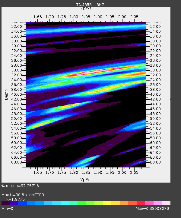
435B Jarrell, TX, USA - Earthquake Result Viewer

Earthquake location: Off East Coast Of Honshu, Japan
Earthquake latitude/longitude: 40.9/144.9
Earthquake time(UTC): 2012/03/14 (074) 09:08:35 GMT
Earthquake Depth: 12 km
Earthquake Magnitude: 6.7 MB, 6.9 MS, 6.9 MW, 7.0 MW
Earthquake Catalog/Contributor: WHDF/NEIC
Network: TA USArray Transportable Network (new EarthScope stations)
Station: 435B Jarrell, TX, USA
Lat/Lon: 30.78 N/97.58 W
Elevation: 248 m
Distance: 88.2 deg
Az: 49.814 deg
Baz: 317.7 deg
Ray Param: 0.04274515
Estimated Moho Depth: 30.5 km
Estimated Crust Vp/Vs: 1.88
Assumed Crust Vp: 6.347 km/s
Estimated Crust Vs: 3.381 km/s
Estimated Crust Poisson's Ratio: 0.30
Radial Match: 97.35716 %
Radial Bump: 390
Transverse Match: 90.77096 %
Transverse Bump: 400
SOD ConfigId: 440406
Insert Time: 2012-05-25 22:44:32.598 +0000
GWidth: 2.5
Max Bumps: 400
Tol: 0.001

Signal To Noise

ChannelStoNSTALTA
TA:435B: :BHZ:20120314T09:20:54.499985Z8.2962161.318537E-61.5893234E-7
TA:435B: :BHN:20120314T09:20:54.499985Z3.9927014.321848E-71.0824372E-7
TA:435B: :BHE:20120314T09:20:54.499985Z1.86222412.55218E-71.370501E-7
Arrivals
Ps4.3 SECOND
PpPs14 SECOND
PsPs/PpSs18 SECOND