
N35A Tabor, IA, USA - Earthquake Result Viewer
| ||||||||||||||||||
| ||||||||||||||||||
| ||||||||||||||||||
|
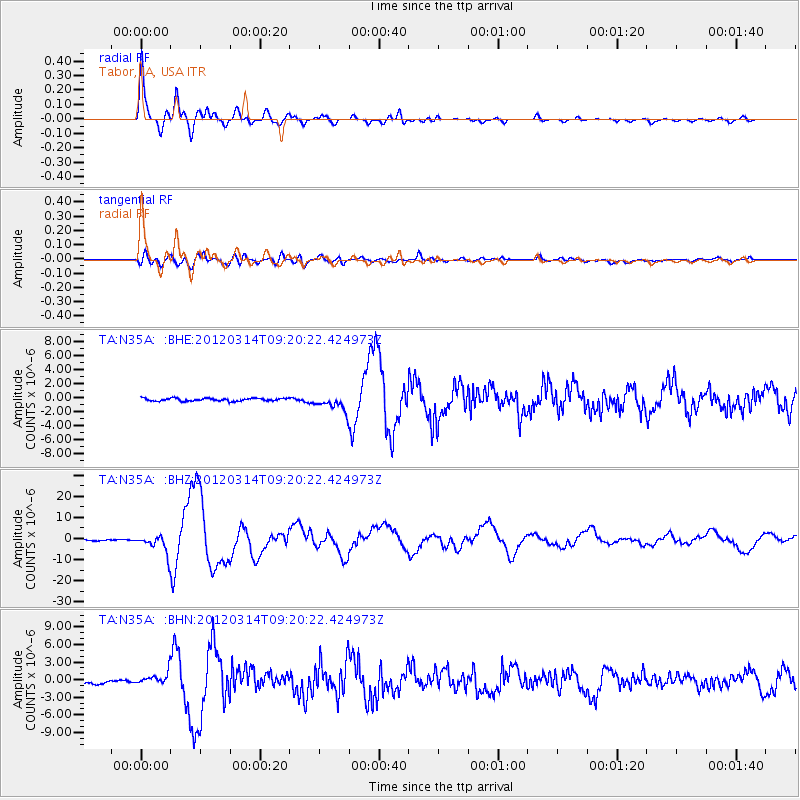
Signal To Noise
| Channel | StoN | STA | LTA |
| TA:N35A: :BHZ:20120314T09:20:22.424973Z | 17.671312 | 4.3402233E-6 | 2.4560845E-7 |
| TA:N35A: :BHN:20120314T09:20:22.424973Z | 3.197279 | 9.994095E-7 | 3.1258128E-7 |
| TA:N35A: :BHE:20120314T09:20:22.424973Z | 5.883845 | 1.1547409E-6 | 1.9625617E-7 |
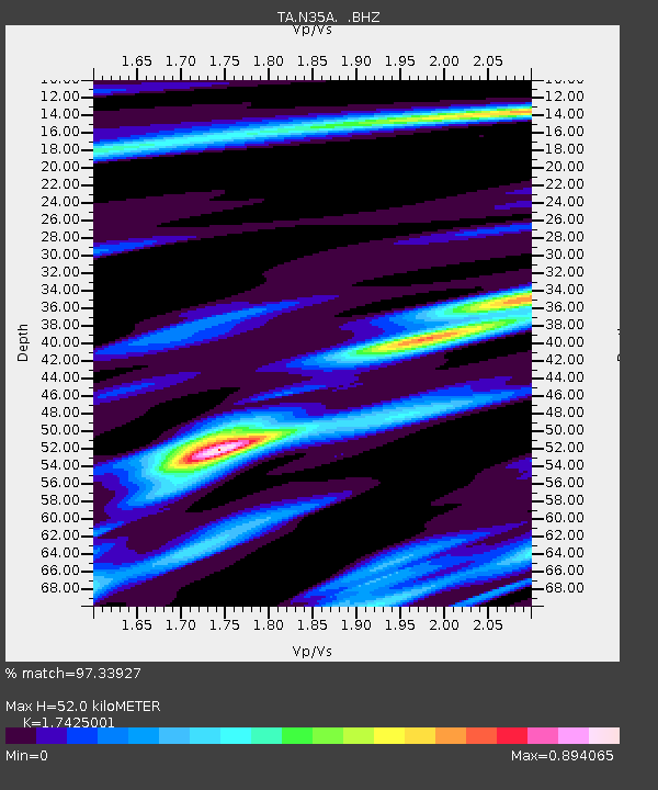
| Arrivals | |
| Ps | 6.1 SECOND |
| PpPs | 21 SECOND |
| PsPs/PpSs | 27 SECOND |

