
O33A Hebron, NE, USA - Earthquake Result Viewer
| ||||||||||||||||||
| ||||||||||||||||||
| ||||||||||||||||||
|
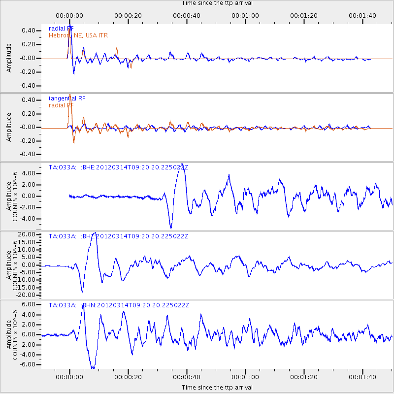
Signal To Noise
| Channel | StoN | STA | LTA |
| TA:O33A: :BHZ:20120314T09:20:20.225022Z | 44.767227 | 6.8499085E-6 | 1.5301167E-7 |
| TA:O33A: :BHN:20120314T09:20:20.225022Z | 14.847583 | 2.3085383E-6 | 1.5548244E-7 |
| TA:O33A: :BHE:20120314T09:20:20.225022Z | 18.548899 | 2.1625656E-6 | 1.16587266E-7 |
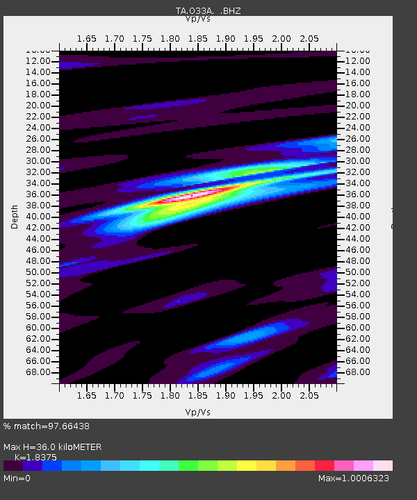
| Arrivals | |
| Ps | 4.8 SECOND |
| PpPs | 15 SECOND |
| PsPs/PpSs | 20 SECOND |

