M35A Neola, IA, USA - Earthquake Result Viewer
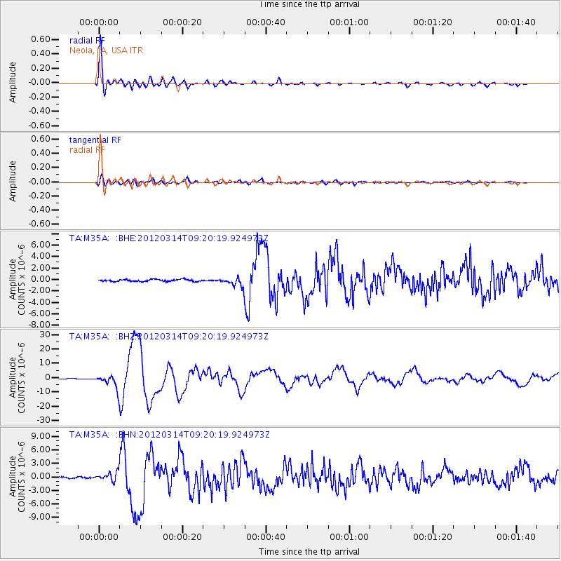
Earthquake location: Off East Coast Of Honshu, Japan
Earthquake latitude/longitude: 40.9/144.9
Earthquake time(UTC): 2012/03/14 (074) 09:08:35 GMT
Earthquake Depth: 12 km
Earthquake Magnitude: 6.7 MB, 6.9 MS, 6.9 MW, 7.0 MW
Earthquake Catalog/Contributor: WHDF/NEIC
Network: TA USArray Transportable Network (new EarthScope stations)
Station: M35A Neola, IA, USA
Lat/Lon: 41.47 N/95.69 W
Elevation: 363 m
Distance: 81.3 deg
Az: 41.497 deg
Baz: 318.055 deg
Ray Param: 0.047659747
Estimated Moho Depth: 29.25 km
Estimated Crust Vp/Vs: 1.84
Assumed Crust Vp: 6.498 km/s
Estimated Crust Vs: 3.531 km/s
Estimated Crust Poisson's Ratio: 0.29
Radial Match: 97.28092 %
Radial Bump: 400
Transverse Match: 86.38797 %
Transverse Bump: 400
SOD ConfigId: 440406
Insert Time: 2012-05-25 22:46:05.142 +0000
GWidth: 2.5
Max Bumps: 400
Tol: 0.001

Signal To Noise

ChannelStoNSTALTA
TA:M35A: :BHZ:20120314T09:20:19.924973Z29.8112584.981654E-61.6710646E-7
TA:M35A: :BHN:20120314T09:20:19.924973Z4.6330129.789395E-72.112966E-7
TA:M35A: :BHE:20120314T09:20:19.924973Z5.0495278.3715065E-71.6578794E-7
Arrivals
Ps3.9 SECOND
PpPs12 SECOND
PsPs/PpSs16 SECOND